
Skeda:Athanasius Kircher's Atlantis.gif
Nuk ka përmasa më të madhaja.
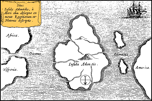
Athanasius_Kircher's_Atlantis.gif ((përmasa 617 × 410 px, madhësia skedës: 36 KB, lloji MIME: image/gif))
| Kjo skedë është prej Wikimedia Commons dhe mund të përdoret nga projekte të tjera. Përshkrimi në këtë skedë në këtë faqe nuk është treguar më poshtë. | Shko tek faqja përshkruese në Commons |
| Përshkrimi |
Latina: Situs Insulae Atlantidis, a mari olim absorpte ex mente Aegyptiorum et Platonis descriptio.
Русский: Карта Атлантиды Афанасия Кирхера, 1669 год. Обратите внимание, север, как показано стрелкой на карте, расположен в нижней части. |
|||||||||||||||||||||||
| Data | circa 1669 | |||||||||||||||||||||||
| Burimi | https://www.haktanir.org/ | |||||||||||||||||||||||
| Autori |
|
|||||||||||||||||||||||
| Versione tjera |
|
|||||||||||||||||||||||


.jpg)
|
This work is in the public domain in its country of origin and other countries and areas where the copyright term is the author's life plus 100 years or fewer. | |
| Kjo skedë është identifikuar si e lirë e kufizimeve të panjohura në ligjin e të drejtave të autorit, duke përfshirë të gjitha të drejtat e lidhura dhe fqinje. | |
Historiku skedës
Shtypni mbi një datë/kohë për ta parë skedën siç ishte atëherë.
| Data/Koha | Miniaturë | Përmasat | Përdoruesi | Koment | |
|---|---|---|---|---|---|
| e tanishme | 15 tetor 2013 14:39 | | 617 × 410 (36 KB) | AnonMoos | Reverted to version as of 01:05, 29 December 2005 -- rotating image turned text upside down |
| 15 tetor 2013 14:37 |  | 617 × 410 (36 KB) | Rotatebot | Bot: Image rotated by 180° | |
| 29 dhjetor 2005 03:05 |  | 617 × 410 (36 KB) | Comae | Tomado de en.wikipedia, donde dice: Author: Athanasius_Kircher's Map of Atlantis (c.1669) Source: http://atlants.haktanir.org/ch3.html This image is in the public domain because its copyright has expired in the United States and those countries with a c |
Lidhje skedash
Këto faqe lidhen tek kjo skedë:
Përdorimi global i skedës
Kjo skedë përdoret nga Wiki të tjera në vijim:
- Përdorimi në af.wikipedia.org
- Përdorimi në an.wikipedia.org
- Përdorimi në ar.wikipedia.org
- Përdorimi në ar.wikiversity.org
- Përdorimi në ast.wikipedia.org
- Përdorimi në az.wikipedia.org
- Përdorimi në be-tarask.wikipedia.org
- Përdorimi në beta.wikiversity.org
- Përdorimi në be.wikipedia.org
- Përdorimi në bg.wikipedia.org
- Përdorimi në bn.wikipedia.org
- Përdorimi në ca.wikipedia.org
- Përdorimi në ceb.wikipedia.org
- Përdorimi në cs.wikipedia.org
- Përdorimi në de.wikipedia.org
- Përdorimi në diq.wikipedia.org
- Përdorimi në el.wikipedia.org
- Përdorimi në en.wikipedia.org
- Përdorimi në en.wikibooks.org
- Përdorimi në en.wikiversity.org
- Përdorimi në en.wikivoyage.org
- Përdorimi në eo.wikipedia.org
- Përdorimi në es.wikipedia.org
- Përdorimi në es.wikibooks.org
- Përdorimi në et.wikipedia.org
- Përdorimi në eu.wikipedia.org
- Përdorimi në fi.wikibooks.org
- Përdorimi në fr.wiktionary.org
- Përdorimi në fy.wikipedia.org
- Përdorimi në gl.wikipedia.org
Shikoni më shumë përdorim global të kësaj skede.