
Skeda:SD-CountyMap.jpg
Madhësia e këtij shikimi: 800 × 490 pixel. Rezolucione të tjera: 320 × 196 pixel | 640 × 392 pixel | 847 × 519 pixel.
Dokument origjinal ((përmasa 847 × 519 px, madhësia skedës: 61 KB, lloji MIME: image/jpeg))
| Kjo skedë është prej Wikimedia Commons dhe mund të përdoret nga projekte të tjera. Përshkrimi në këtë skedë në këtë faqe nuk është treguar më poshtë. | Shko tek faqja përshkruese në Commons |
Përmbledhje
| Përshkrimi |
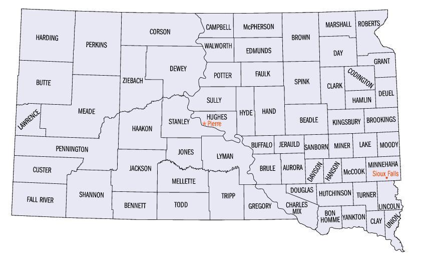
English: Map of South Dakota counties. |
| Burimi | https://web.archive.org/web/20050204100123/http://www.fedstats.gov/qf/maps/south_dakota_map.html |
| Autori | United States Census Bureau |


Licencim
This image or file is a work of a United States Census Bureau employee, taken or made as part of that person's official duties. As a work of the U.S. federal government, the image is in the public domain.
|
 |
Historiku skedës
Shtypni mbi një datë/kohë për ta parë skedën siç ishte atëherë.
| Data/Koha | Miniaturë | Përmasat | Përdoruesi | Koment | |
|---|---|---|---|---|---|
| e tanishme | 13 tetor 2006 23:07 | | 847 × 519 (61 KB) | JosN | Map of South Dakota counties. |
Lidhje skedash
Këto faqe lidhen tek kjo skedë:
Përdorimi global i skedës
Kjo skedë përdoret nga Wiki të tjera në vijim:
- Përdorimi në en.wikipedia.org
- Përdorimi në es.wikipedia.org
- Përdorimi në fr.wikipedia.org
- Përdorimi në he.wikipedia.org
- Përdorimi në it.wikipedia.org
- Përdorimi në ja.wikipedia.org
- Përdorimi në nds.wikipedia.org
- Përdorimi në nl.wikipedia.org
- Përdorimi në pt.wikipedia.org
- Përdorimi në ro.wikipedia.org
- Përdorimi në sv.wikipedia.org