
Skeda:SD Capitol.jpg
Madhësia e këtij shikimi: 800 × 455 pixel. Rezolucione të tjera: 320 × 182 pixel | 640 × 364 pixel | 1.024 × 583 pixel | 1.280 × 729 pixel | 2.921 × 1.663 pixel.
Dokument origjinal ((përmasa 2.921 × 1.663 px, madhësia skedës: 6,69 MB, lloji MIME: image/jpeg))
| Kjo skedë është prej Wikimedia Commons dhe mund të përdoret nga projekte të tjera. Përshkrimi në këtë skedë në këtë faqe nuk është treguar më poshtë. | Shko tek faqja përshkruese në Commons |
Përmbledhje
| Përshkrimi |
This image was created with Hugin. |
||
| Data | |||
| Burimi | Punë e juaja | ||
| Autori | Jake DeGroot | ||
| Leja (Ripërdor këtë skedë) |
Jake DeGroot, krijuesi i kësaj pune, e publikon këtu në bazë të licensës në vijim: Kjo skedë licencohet sipas Creative Commons Attribution-Share Alike 3.0 Unported. Atribuim: Jake DeGroot
|

| Camera location | | View this and other nearby images on: OpenStreetMap |
|---|

|
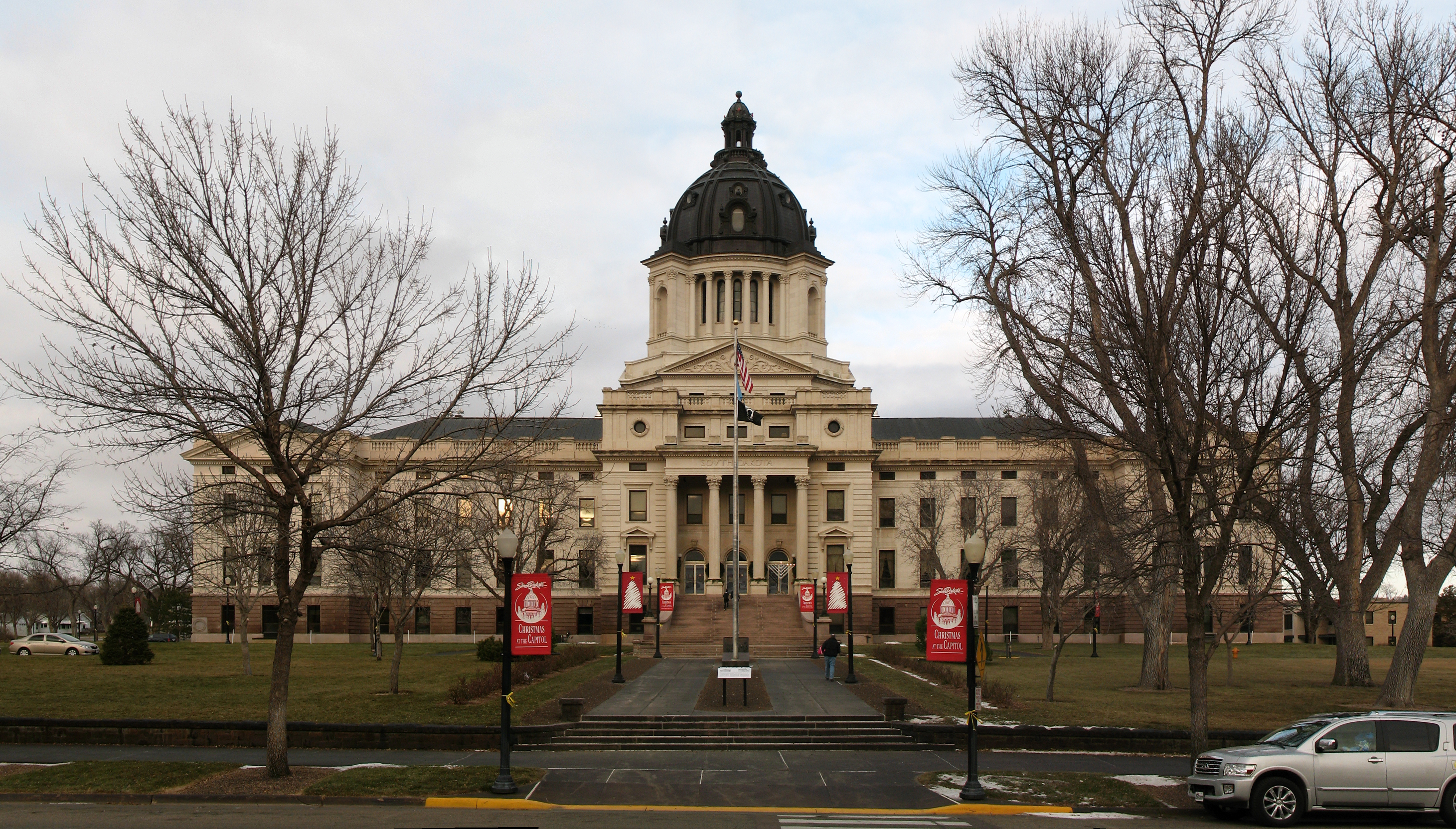
NOTE: This image is a panorama of South Dakota State Capitol consisting of 3 frames that were merged or stitched in Hugin. As a result, this image necessarily underwent some form of digital manipulation. These manipulations may include blending, blurring, cloning, and colour and perspective adjustments. As a result of these adjustments, the image content may be slightly different from reality at the points where multiple images were combined. This manipulation is often required due to lens, perspective, and parallax distortions.
|
Historiku skedës
Shtypni mbi një datë/kohë për ta parë skedën siç ishte atëherë.
| Data/Koha | Miniaturë | Përmasat | Përdoruesi | Koment | |
|---|---|---|---|---|---|
| e tanishme | 4 prill 2011 00:06 | | 2.921 × 1.663 (6,69 MB) | Sdgjake | {{Information |Description ={{en|1=The South Dakota State Capitol building in Pierre, South Dakota.}} |Source ={{own}} |Author =Jake DeGroot |Date =2010-12-04 |Permission ={{User:sdgjake/credit}} {{self|cc |
Lidhje skedash
S’ka faqe që përdorin këtë kartelë.
Përdorimi global i skedës
Kjo skedë përdoret nga Wiki të tjera në vijim:
- Përdorimi në af.wikipedia.org
- Përdorimi në am.wikipedia.org
- Përdorimi në azb.wikipedia.org
- Përdorimi në bn.wikipedia.org
- Përdorimi në de.wikipedia.org
- Përdorimi në el.wikipedia.org
- Përdorimi në en.wikipedia.org
- Përdorimi në en.wikivoyage.org
- Përdorimi në es.wikipedia.org
- Përdorimi në et.wikipedia.org
- Përdorimi në fi.wikipedia.org
- Përdorimi në fo.wikipedia.org
- Përdorimi në fy.wikipedia.org
- Përdorimi në gd.wikipedia.org
- Përdorimi në he.wikipedia.org
- Përdorimi në it.wikipedia.org
- Përdorimi në it.wikivoyage.org
- Përdorimi në la.wikipedia.org
- Përdorimi në mi.wikipedia.org
- Përdorimi në nl.wikipedia.org
- Përdorimi në nov.wikipedia.org
- Përdorimi në no.wikipedia.org
- Përdorimi në pnb.wikipedia.org
- Përdorimi në pt.wikipedia.org
- Përdorimi në ro.wikipedia.org
- Përdorimi në ru.wikipedia.org
- Përdorimi në sw.wikipedia.org
- Përdorimi në th.wikipedia.org
- Përdorimi në tum.wikipedia.org
- Përdorimi në uk.wikipedia.org
- Përdorimi në uz.wikipedia.org
- Përdorimi në vi.wikipedia.org
- Përdorimi në www.wikidata.org