
Skeda:1849 Mitchell Map of Turkey ( Iraq, Syria, Palestine ) - Geographicus - TurkeyAsia-m-1849.jpg

Madhësia e këtij shikimi: 732 × 600 pixel. Rezolucione të tjera: 293 × 240 pixel | 586 × 480 pixel | 938 × 768 pixel | 1.250 × 1.024 pixel | 2.501 × 2.048 pixel | 4.000 × 3.276 pixel.
Dokument origjinal ((përmasa 4.000 × 3.276 px, madhësia skedës: 2,89 MB, lloji MIME: image/jpeg))
| Kjo skedë është prej Wikimedia Commons dhe mund të përdoret nga projekte të tjera. Përshkrimi në këtë skedë në këtë faqe nuk është treguar më poshtë. | Shko tek faqja përshkruese në Commons |
_-_Geographicus_-_TurkeyAsia-m-1849.jpg)
| Samuel Augustus Mitchell: Turkey in Asia.
( |
||||||||||||||||||||
|---|---|---|---|---|---|---|---|---|---|---|---|---|---|---|---|---|---|---|---|---|
| Artist |
|
|||||||||||||||||||
| Title |
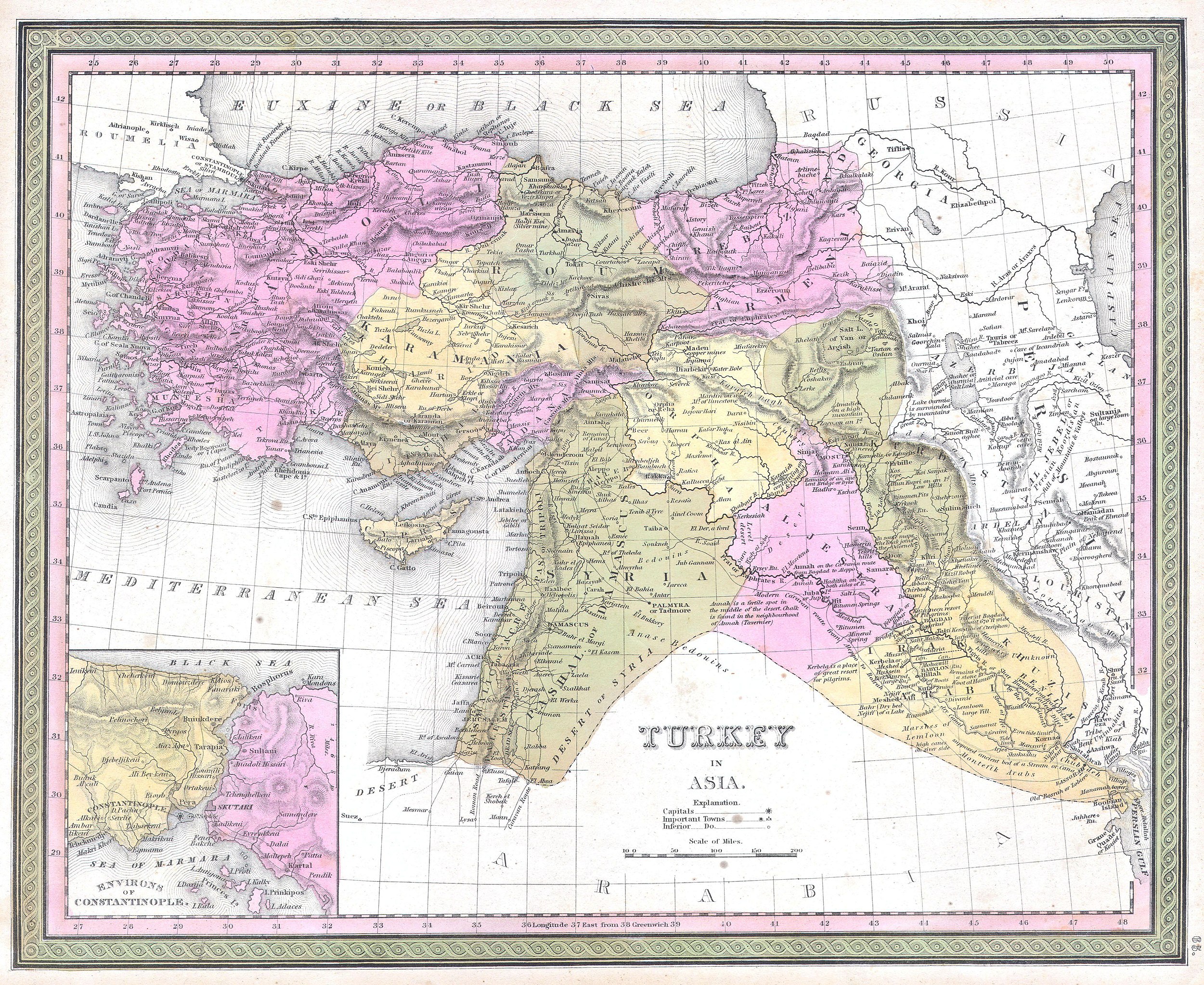
Turkey in Asia. |
|||||||||||||||||||
| Përshkrimi |
English: This beautiful hand colored map is a lithographic engraving of Turkey in Asia, dating to 1849. Beautiful map depicts most of modern day nations of Turkey, Iran, Iraq, Israel, Palestine, Jordan, Syria, Lebanon and Kuwait. There is a beautiful inset of the Environs of Constantinople or Istanbul. Produced by the legendary American map publisher S. A. Mitchell Sr. in conjunction with the Cowperthwait firm of Philadelphia, PA. |
|||||||||||||||||||
| Data | 1849 | |||||||||||||||||||
| Dimensions | lartësi: 12,5 in (31,7 cm); gjerësi: 15,5 in (39,3 cm) | |||||||||||||||||||
| Accession number |
Geographicus link: TurkeyAsia-m-1849 |
|||||||||||||||||||
| Source/Photographer |
|
|||||||||||||||||||
| Leja (Ripërdor këtë skedë) |
|
|||||||||||||||||||
Historiku skedës
Shtypni mbi një datë/kohë për ta parë skedën siç ishte atëherë.
| Data/Koha | Miniaturë | Përmasat | Përdoruesi | Koment | |
|---|---|---|---|---|---|
| e tanishme | 15 mars 2011 23:03 | | 4.000 × 3.276 (2,89 MB) | BotMultichill | {{subst:User:Multichill/Geographicus |link=http://www.geographicus.com/P/AntiqueMap/TurkeyAsia-m-1849 |product_name=1849 Mitchell Map of Turkey ( Iraq, Syria, Palestine ) |map_title=Turkey in Asia. |description=This beautiful hand colored map is a lithogr |
Lidhje skedash
Këto faqe lidhen tek kjo skedë:
Përdorimi global i skedës
Kjo skedë përdoret nga Wiki të tjera në vijim:
- Përdorimi në ar.wikipedia.org
- Përdorimi në azb.wikipedia.org
- Përdorimi në az.wikipedia.org
- Përdorimi në bn.wikipedia.org
- Përdorimi në en.wikipedia.org
- Përdorimi në fa.wikipedia.org
- Përdorimi në it.wikipedia.org
- Përdorimi në ja.wikipedia.org
- Përdorimi në ko.wikipedia.org
- Përdorimi në ms.wikipedia.org
- Përdorimi në ru.wikipedia.org
- Përdorimi në sl.wikipedia.org
- Përdorimi në tr.wikipedia.org
- Përdorimi në uk.wikipedia.org
- Përdorimi në www.wikidata.org
- Përdorimi në zh.wikipedia.org
_-_Geographicus_-_TurkeyAsia-m-1849.jpg)