
Skeda:Albania District.svg

Size of this PNG preview of this SVG file: 304 × 600 pixel. Rezolucione të tjera: 121 × 240 pixel | 243 × 480 pixel | 389 × 768 pixel | 519 × 1.024 pixel | 1.038 × 2.048 pixel | 508 × 1.002 pixel.
Dokument origjinal (skedë SVG, fillimisht 508 × 1.002 pixel, madhësia e skedës: 276 KB)
| Kjo skedë është prej Wikimedia Commons dhe mund të përdoret nga projekte të tjera. Përshkrimi në këtë skedë në këtë faqe nuk është treguar më poshtë. | Shko tek faqja përshkruese në Commons |
| Përshkrimi |
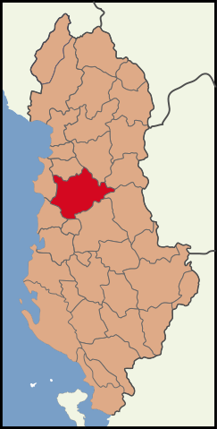
English: Albania location Tirana County.
Blank map of the districts of Albania, useful for numbering/labelling for other languages. |
||
| Data | (UTC) | ||
| Burimi | |||
| Autori |
|
||
| SVG genesis | This W3C-invalid map was created with Adobe Illustrator.
|
Kjo skedë licencohet sipas Creative Commons Attribution-Share Alike 3.0 Unported.
- Je i lirë të:
- ta shpërndani – ta kopjoni, rishpërndani dhe përcillni punën
- t’i bëni “remix” – të përshtatni punën
- Sipas kushteve të mëposhtme:
- atribuim – Duhet t’i jepni meritat e duhura, të siguroni një lidhje për tek licenca dhe të tregoni nëse janë bërë ndryshime. Këtë mund ta bëni në ndonjë mënyrë të arsyeshme, por jo në ndonjë mënyrë që sugjeron se licencuesi ju del zot juve apo përdorimit tuaj.
- share alike – Nëse bëni një “remix”, e shndërroni, ose ndërtoni duke u bazuar te materiali, duhet t’i shpërndani kontributet tuaja sipas të njëjtës licencë ose një të tille të përputhshme me origjinalen.
Regjistri origjinal i ngarkimeve
This image is a derivative work of the following images:
- File:Albania location Tirana.svg licensed with Cc-by-3.0
- 2010-03-30T16:55:33Z The Emirr 508x1002 (201332 Bytes) {{Information |Description={{en|1=Albania location Tirana County.}} |Source={{own}} |Author={{click|image=TheEmirr-Logo.png|link=User:The Emirr|width=60px|height=60px}} |Date=2010-03-30 |Permission={{The Emirr}} |other_versio
- File:Albania districts.svg licensed with Cc-by-2.5, Cc-by-sa-3.0-migrated, GFDL
- 2011-05-07T19:36:03Z Malyszkz 1000x2112 (113600 Bytes) change border size
- 2011-05-07T18:46:45Z Malyszkz 1000x2112 (113609 Bytes) {{Information |Description=Blank map of the districts of Albania, useful for numbering/labelling for other languages. |Source=*[[:File:Albania_districts_blank_2.svg|]] |Date=2011-05-07 18:46 (UTC) |Author=*[[:File:Albania_dis
Uploaded with derivativeFX
Historiku skedës
Shtypni mbi një datë/kohë për ta parë skedën siç ishte atëherë.
| Data/Koha | Miniaturë | Përmasat | Përdoruesi | Koment | |
|---|---|---|---|---|---|
| e tanishme | 8 maj 2011 14:18 | | 508 × 1.002 (276 KB) | Vinie007 | color fix |
| 8 maj 2011 14:00 |  | 508 × 1.002 (276 KB) | Malyszkz | {{Information |Description={{en|1=Albania location Tirana County.}} Blank map of the districts of Albania, useful for numbering/labelling for other languages. |Source=*File:Albania_location_Tirana.svg *File:Albania_districts.svg |Date=2011-05- |
Lidhje skedash
Këto faqe lidhen tek kjo skedë:
Përdorimi global i skedës
Kjo skedë përdoret nga Wiki të tjera në vijim:
- Përdorimi në dv.wikipedia.org
- Përdorimi në en.wikipedia.org
- Përdorimi në fa.wikipedia.org
- Përdorimi në incubator.wikimedia.org
- Përdorimi në lt.wikipedia.org
- Përdorimi në nap.wikipedia.org
- Përdorimi në pa.wikipedia.org
- Përdorimi në pnt.wikipedia.org
- Përdorimi në rm.wikipedia.org
- Përdorimi në ru.wikipedia.org
- Përdorimi në sco.wikipedia.org
- Përdorimi në simple.wikipedia.org
- Përdorimi në sr.wikipedia.org
- Përdorimi në ti.wikipedia.org
- Përdorimi në vi.wikipedia.org