
Skeda:Balkans 1265.jpg
Balkans_1265.jpg ((përmasa 600 × 422 px, madhësia skedës: 75 KB, lloji MIME: image/jpeg))
| Kjo skedë është prej Wikimedia Commons dhe mund të përdoret nga projekte të tjera. Përshkrimi në këtë skedë në këtë faqe nuk është treguar më poshtë. | Shko tek faqja përshkruese në Commons |
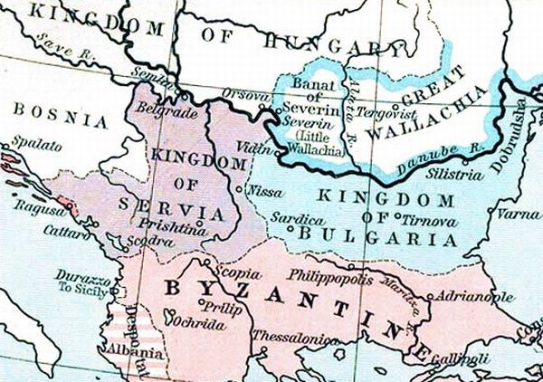
| Përshkrimi | States in the Balkans in the 13th century (1265). The Historical Atlas, William R. Shepherd, 1911. | ||||
| Data | (UTC) | ||||
| Burimi | |||||
| Autori |
|
||||
| Leja (Ripërdor këtë skedë) |
|
||||
| Versione tjera |
 |
||||
Regjistri origjinal i ngarkimeve
This image is a derivative work of the following images:
- File:ShepherdByzempire1265.jpg licensed with PD-old
- 2009-07-12T16:26:21Z Alex:D 1144x900 (287421 Bytes) whitened
- 2009-07-12T16:17:18Z Alex:D 1144x900 (287421 Bytes) whitened
- 2009-07-12T16:12:47Z Alex:D 1144x900 (287421 Bytes) whitened
- 2004-12-21T13:40:55Z Mschlindwein 1144x900 (278685 Bytes) Map, The Byzantine Empire, 1265. The Historical Atlas, William R. Shepherd, 1911.
Uploaded with derivativeFX
Historiku skedës
Shtypni mbi një datë/kohë për ta parë skedën siç ishte atëherë.
| Data/Koha | Miniaturë | Përmasat | Përdoruesi | Koment | |
|---|---|---|---|---|---|
| e tanishme | 16 nëntor 2022 17:28 | | 600 × 422 (75 KB) | Gyalu22 | You can't redraw the atlas |
| 20 maj 2016 17:24 |  | 748 × 900 (614 KB) | Julieta39 | Details : see discussion file | |
| 27 janar 2010 23:16 |  | 600 × 422 (75 KB) | Mladifilozof | {{Information |Description=States in the Balkans in the 13th century (1265). The Historical Atlas, William R. Shepherd, 1911. |Source=*File:ShepherdByzempire1265.jpg |Date=2010-01-27 21:14 (UTC) |Author=*File:ShepherdByzempire1265.jpg: William |
Lidhje skedash
Këto faqe lidhen tek kjo skedë:
Përdorimi global i skedës
Kjo skedë përdoret nga Wiki të tjera në vijim:
- Përdorimi në be.wikipedia.org
- Përdorimi në bg.wikipedia.org
- Përdorimi në cs.wikipedia.org
- Përdorimi në de.wikipedia.org
- Përdorimi në el.wikipedia.org
- Përdorimi në en.wikipedia.org
- Përdorimi në et.wikipedia.org
- Përdorimi në fa.wikipedia.org
- Përdorimi në gl.wikipedia.org
- Përdorimi në he.wikipedia.org
- Përdorimi në hr.wikipedia.org
- Përdorimi në id.wikipedia.org
- Përdorimi në ja.wikipedia.org
- Përdorimi në ko.wikipedia.org
- Përdorimi në lt.wikipedia.org
- Përdorimi në mk.wikipedia.org
- Përdorimi në oc.wikipedia.org
- Përdorimi në ro.wikipedia.org
- Përdorimi në ru.wikipedia.org
- Përdorimi në sh.wikipedia.org
- Përdorimi në sl.wikipedia.org
- Përdorimi në sr.wikipedia.org
- Përdorimi në sv.wikipedia.org
- Përdorimi në tr.wikipedia.org
- Përdorimi në zh.wikipedia.org