
Skeda:Croatian Prevlaka in occupation by Montenegro and Serbia.jpg
Nuk ka përmasa më të madhaja.
Croatian_Prevlaka_in_occupation_by_Montenegro_and_Serbia.jpg ((përmasa 760 × 560 px, madhësia skedës: 118 KB, lloji MIME: image/jpeg))
| Kjo skedë është prej Wikimedia Commons dhe mund të përdoret nga projekte të tjera. Përshkrimi në këtë skedë në këtë faqe nuk është treguar më poshtë. | Shko tek faqja përshkruese në Commons |
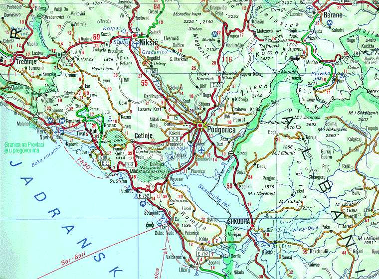
| Përshkrimi | Map of Montenegrin Littoral Region and Boka kotorska in the time of occupation of Croatian Prevlaka Region which is the remaining part of Boka kotorska that belongs to Croatia. | |||
| Data | 1991-2002 (occupation ended 1992-10-20 at 20:30) (UNMIK mission ended 2002-12-20). | |||
| Burimi | Ministry of Foreign Affairs of the State Union Serbia and Montenegro (before that MFA of Federal Republic of Yugoslavia | |||
| Autori | Serbian Official Cartography (Public Service at the time). | |||
| Leja (Ripërdor këtë skedë) |
|
|||
| Versione tjera | Geographical version. |

Historiku skedës
Shtypni mbi një datë/kohë për ta parë skedën siç ishte atëherë.
| Data/Koha | Miniaturë | Përmasat | Përdoruesi | Koment | |
|---|---|---|---|---|---|
| e tanishme | 16 shkurt 2008 04:05 | | 760 × 560 (118 KB) | Imbris~commonswiki | {{Information |Description=Map of Montenegrin ''Littoral Region'' and ''Boka kotorska'' in the time of occupation of Croatian hr:Prevlaka Region which is the remaining part of Boka kotorska that belongs to Croatia. |Source=[http://www.mfa.gov.yu/Fact |
Lidhje skedash
Këto faqe lidhen tek kjo skedë:
Përdorimi global i skedës
Kjo skedë përdoret nga Wiki të tjera në vijim:
- Përdorimi në ca.wikipedia.org
- Përdorimi në ckb.wikipedia.org
- Përdorimi në de.wikipedia.org
- Përdorimi në en.wikipedia.org
- Përdorimi në fa.wikipedia.org
- Përdorimi në hr.wikipedia.org
- Përdorimi në id.wikipedia.org
- Përdorimi në mzn.wikipedia.org
- Përdorimi në nl.wikipedia.org
- Përdorimi në ru.wikipedia.org
- Përdorimi në sh.wikipedia.org
- Përdorimi në www.wikidata.org
- Përdorimi në zh.wikipedia.org