
Skeda:Devon UK locator map 2010.svg

Size of this PNG preview of this SVG file: 494 × 600 pixel. Rezolucione të tjera: 198 × 240 pixel | 395 × 480 pixel | 633 × 768 pixel | 843 × 1.024 pixel | 1.687 × 2.048 pixel | 1.108 × 1.345 pixel.
Dokument origjinal (skedë SVG, fillimisht 1.108 × 1.345 pixel, madhësia e skedës: 302 KB)
| Kjo skedë është prej Wikimedia Commons dhe mund të përdoret nga projekte të tjera. Përshkrimi në këtë skedë në këtë faqe nuk është treguar më poshtë. | Shko tek faqja përshkruese në Commons |
Përmbledhje
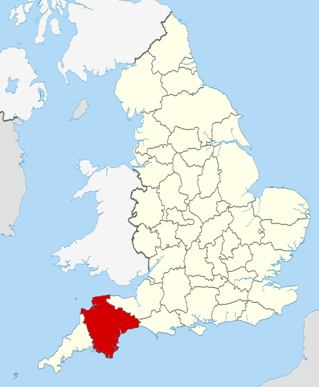
| Përshkrimi | Location of the ceremonial county of Devon within England. |
| Data | |
| Burimi |
National Geospatial-Intelligence Agency
|
| Autori | Nilfanion |
Licencim
Unë, krijuesi i kësaj pune, e publikoj këtu në bazë të licensës në vijim:
Kjo skedë licencohet sipas Creative Commons Attribution-Share Alike 3.0 Unported.
- Je i lirë të:
- ta shpërndani – ta kopjoni, rishpërndani dhe përcillni punën
- t’i bëni “remix” – të përshtatni punën
- Sipas kushteve të mëposhtme:
- atribuim – Duhet t’i jepni meritat e duhura, të siguroni një lidhje për tek licenca dhe të tregoni nëse janë bërë ndryshime. Këtë mund ta bëni në ndonjë mënyrë të arsyeshme, por jo në ndonjë mënyrë që sugjeron se licencuesi ju del zot juve apo përdorimit tuaj.
- share alike – Nëse bëni një “remix”, e shndërroni, ose ndërtoni duke u bazuar te materiali, duhet t’i shpërndani kontributet tuaja sipas të njëjtës licencë ose një të tille të përputhshme me origjinalen.

|
Ju jepet leje për ta kopjuar, shpërndarë dhe/ose ndryshuar këtë dokument sipas kushteve të Licencës GNU për Dokumentim të Lirë, versioni 1.2 ose çfarëdo versioni të mëpasshëm të botuar nga Free Software Foundation; pa Seksione të Pandryshueshme, pa Tekste Kapakësh të Përparmë, dhe pa Tekste Kapakësh të Pasmë. Një kopje e kësaj licence është përfshirë në seksionin e titulluar GNU Free Documentation License. |
Mundeni të përzgjidhni licencën që doni.

|
This is one of the images forming part of the Valued image set: Locator maps of the Ceremonial counties of England on Wikimedia Commons. The image set has been assessed under the valued image set criteria and is considered the most valued set on Commons within the scope:
Locator maps of the Ceremonial counties of England
You can see its nomination at Commons:Valued image candidates/Locator maps of English ceremonial counties. |
Historiku skedës
Shtypni mbi një datë/kohë për ta parë skedën siç ishte atëherë.
| Data/Koha | Miniaturë | Përmasat | Përdoruesi | Koment | |
|---|---|---|---|---|---|
| e tanishme | 24 nëntor 2010 00:33 | | 1.108 × 1.345 (302 KB) | Nilfanion | == Summary == {{Information |Description=Location of the ceremonial county of Devon within England. |Source=Ordnance Survey [https://www.ordnancesurvey.co.uk/opendatadownload/products.html OpenData]: *County boundaries an |
Lidhje skedash
Këto faqe lidhen tek kjo skedë:
Përdorimi global i skedës
Kjo skedë përdoret nga Wiki të tjera në vijim:
- Përdorimi në af.wikipedia.org
- Përdorimi në an.wikipedia.org
- Përdorimi në arz.wikipedia.org
- Përdorimi në ast.wikipedia.org
- Përdorimi në az.wikipedia.org
- Përdorimi në be-tarask.wikipedia.org
- Përdorimi në be.wikipedia.org
- Përdorimi në bg.wikipedia.org
- Përdorimi në ca.wikipedia.org
- Përdorimi në ceb.wikipedia.org
- Përdorimi në cs.wikipedia.org
- Përdorimi në el.wikipedia.org
- Përdorimi në en.wikipedia.org
- Devon
- Hamoaze
- Millbridge, Plymouth
- Postbridge
- River Avon, Devon
- Stonehouse Creek
- Morice Town
- Sampford Courtenay
- Leigham
- Bantham Cross
- River Tavy
- River Walkham
- River Lumburn
- River Wallabrooke
- River Burn, Devon
- Collybrooke
- Butterdon Hill
- Stibb Cross
- Black Torrington
- Manaton
- Poundsgate
- Starcross
- East Portlemouth
- Kingsbridge Estuary
- Crownhill
- Eggbuckland
- Laira
- Lipson
- Combe, Yealmpton, Devon
- Combe, Buckfastleigh, Devon
- Combe Fishacre
- Combe Pafford
- Combe Raleigh
- Start Point, Devon
- Coombe, East Devon
Shikoni më shumë përdorim global të kësaj skede.