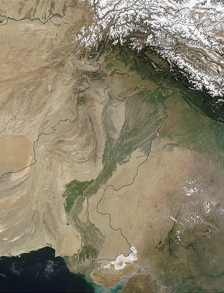
Skeda:Indus.A2002274.0610.1km.jpg

Madhësia e këtij shikimi: 458 × 599 pixel. Rezolucione të tjera: 183 × 240 pixel | 367 × 480 pixel | 587 × 768 pixel | 783 × 1.024 pixel | 1.300 × 1.700 pixel.
Dokument origjinal ((përmasa 1.300 × 1.700 px, madhësia skedës: 480 KB, lloji MIME: image/jpeg))
Historiku skedës
Shtypni mbi një datë/kohë për ta parë skedën siç ishte atëherë.
| Data/Koha | Miniaturë | Përmasat | Përdoruesi | Koment | |
|---|---|---|---|---|---|
| e tanishme | 28 mars 2008 15:03 |  | 1.300 × 1.700 (480 KB) | File Upload Bot (Magnus Manske) | {{BotMoveToCommons|en.wikipedia}} {{Information |Description={{en|en:Satellite image of the en:Indus River basin. Red dots indicate fires. International boundaries are superimposed; the boundary through en:Jammu and Kashmir reflects the [[ |
Lidhje skedash
Këto faqe lidhen tek kjo skedë:
Përdorimi global i skedës
Kjo skedë përdoret nga Wiki të tjera në vijim:
- Përdorimi në af.wikipedia.org
- Përdorimi në ar.wikipedia.org
- Përdorimi në arz.wikipedia.org
- Përdorimi në ast.wikipedia.org
- Përdorimi në as.wikipedia.org
- Përdorimi në azb.wikipedia.org
- Përdorimi në az.wikipedia.org
- Përdorimi në ba.wikipedia.org
- Përdorimi në be-tarask.wikipedia.org
- Përdorimi në bh.wikipedia.org
- Përdorimi në bn.wikipedia.org
- Përdorimi në bo.wikipedia.org
- Përdorimi në br.wikipedia.org
- Përdorimi në bxr.wikipedia.org
- Përdorimi në ca.wikipedia.org
- Përdorimi në ceb.wikipedia.org
- Përdorimi në ce.wikipedia.org
- Përdorimi në ckb.wikipedia.org
- Përdorimi në cy.wikipedia.org
- Përdorimi në da.wikipedia.org
- Përdorimi në en.wikipedia.org
- Përdorimi në eo.wikipedia.org
- Përdorimi në es.wikipedia.org
- Përdorimi në fa.wikipedia.org
- Përdorimi në fiu-vro.wikipedia.org
- Përdorimi në gd.wikipedia.org
- Përdorimi në gl.wikipedia.org
- Përdorimi në hi.wikipedia.org
- Përdorimi në hy.wikipedia.org
- Përdorimi në ia.wikipedia.org
- Përdorimi në id.wikipedia.org
- Përdorimi në ilo.wikipedia.org
- Përdorimi në incubator.wikimedia.org
- Përdorimi në is.wikipedia.org
- Përdorimi në it.wikipedia.org
Shikoni më shumë përdorim global të kësaj skede.


