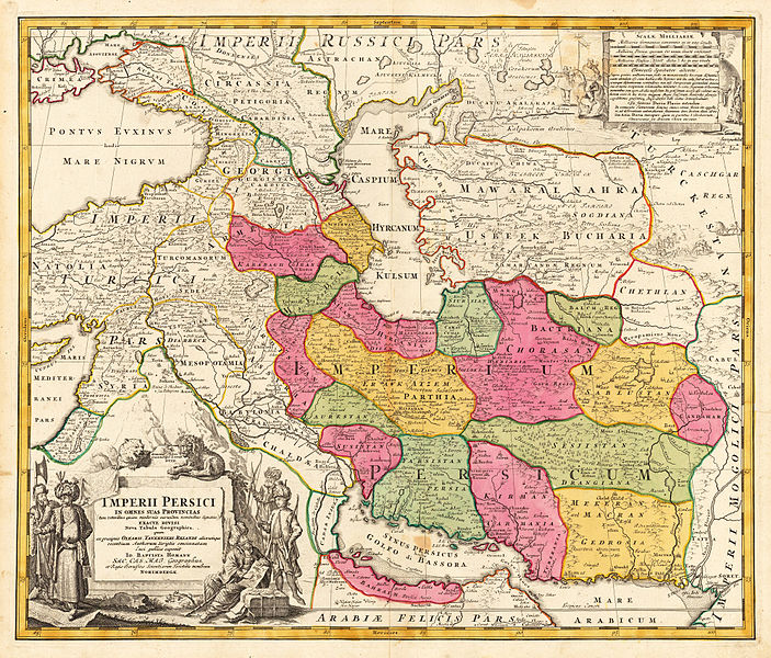
Skeda:Jomann Imperium Periscum.jpg

Madhësia e këtij shikimi: 703 × 600 pixel. Rezolucione të tjera: 281 × 240 pixel | 563 × 480 pixel | 900 × 768 pixel | 1.200 × 1.024 pixel | 1.992 × 1.700 pixel.
Dokument origjinal ((përmasa 1.992 × 1.700 px, madhësia skedës: 2,18 MB, lloji MIME: image/jpeg))
Historiku skedës
Shtypni mbi një datë/kohë për ta parë skedën siç ishte atëherë.
| Data/Koha | Miniaturë | Përmasat | Përdoruesi | Koment | |
|---|---|---|---|---|---|
| e tanishme | 16 nëntor 2015 23:50 |  | 1.992 × 1.700 (2,18 MB) | Taron Saharyan | в лучшем качестве |
| 20 shtator 2010 00:14 |  | 768 × 648 (386 KB) | Geagea | Reverted to version as of 22:42, 13 February 2006 | |
| 20 shtator 2010 00:13 |  | 650 × 572 (194 KB) | Geagea | new | |
| 14 shkurt 2006 00:42 |  | 768 × 648 (386 KB) | AndreasPraefcke | Johann Baptista Homann (1644–1724): Map of Persia, c. 1700 Copperplate print on paper, colorized, 53 × 60.7 cm {{PD-art}} Source: http://www.lot-tissimo.net/ Category:Historical Maps of Asia Category:Maps of Iran |
Lidhje skedash
Këto faqe lidhen tek kjo skedë:
Përdorimi global i skedës
Kjo skedë përdoret nga Wiki të tjera në vijim:
- Përdorimi në ace.wikipedia.org
- Përdorimi në ba.wikipedia.org
- Përdorimi në bs.wikipedia.org
- Përdorimi në ckb.wikipedia.org
- Përdorimi në cs.wikipedia.org
- Përdorimi në de.wikipedia.org
- Përdorimi në en.wikipedia.org
- Sistan
- Talk:Safavid dynasty/Archive 10
- User:Khodabandeh14/On Safavid Article
- User:Khodabandeh14/Safavids/OfficalNameOrigin
- User talk:Khodabandeh14/Safavids/OfficalNameOrigin
- Talk:Safavid dynasty/Archive 12
- Talk:Safavid dynasty/Archive 13
- Don–Volga portage
- User:Falcaorib
- Shahr-i Gholghola
- Template:Sistan
- Trakhun
- Përdorimi në es.wikipedia.org
- Përdorimi në fa.wikipedia.org
- Përdorimi në fa.wikibooks.org
- Përdorimi në hr.wikipedia.org
- Përdorimi në hy.wikipedia.org
- Përdorimi në id.wikipedia.org
- Përdorimi në incubator.wikimedia.org
- Përdorimi në ja.wikipedia.org
- Përdorimi në ka.wikipedia.org
- Përdorimi në mr.wikipedia.org
Shikoni më shumë përdorim global të kësaj skede.


