
Skeda:Lake Chad 1973.jpg
Madhësia e këtij shikimi: 584 × 600 pixel. Rezolucione të tjera: 234 × 240 pixel | 467 × 480 pixel | 971 × 997 pixel.
Dokument origjinal ((përmasa 971 × 997 px, madhësia skedës: 553 KB, lloji MIME: image/jpeg))
| Kjo skedë është prej Wikimedia Commons dhe mund të përdoret nga projekte të tjera. Përshkrimi në këtë skedë në këtë faqe nuk është treguar më poshtë. | Shko tek faqja përshkruese në Commons |
Përmbledhje
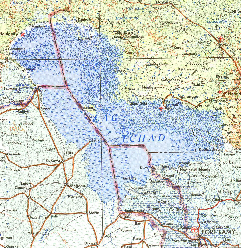
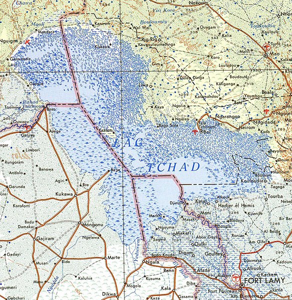
Cropped from public domain US army map from PCL map collection, located here. Specifically, Fort Lamy Sheet 13, Edition 4, DMATC, 1973.
Licencim
This file is a work of a U.S. Army soldier or employee, taken or made as part of that person's official duties. As a work of the U.S. federal government, it is in the public domain in the United States.
|
 |
Historiku skedës
Shtypni mbi një datë/kohë për ta parë skedën siç ishte atëherë.
| Data/Koha | Miniaturë | Përmasat | Përdoruesi | Koment | |
|---|---|---|---|---|---|
| e tanishme | 19 korrik 2007 14:07 | | 971 × 997 (553 KB) | Roke~commonswiki | Cropped from public domain US army map from PCL map collection, located [http://www.lib.utexas.edu/maps/ams/africa/ here]. Specifically, Fort Lamy Sheet 13, Edition 4, DMATC, 1973. Category:Maps of Chad |
Lidhje skedash
Këto faqe lidhen tek kjo skedë:
Përdorimi global i skedës
Kjo skedë përdoret nga Wiki të tjera në vijim:
- Përdorimi në ar.wikipedia.org
- Përdorimi në bg.wikipedia.org
- Përdorimi në cs.wikipedia.org
- Përdorimi në de.wikipedia.org
- Përdorimi në en.wikipedia.org
- Përdorimi në es.wikipedia.org
- Përdorimi në fa.wikipedia.org
- Përdorimi në fo.wikipedia.org
- Përdorimi në frr.wikipedia.org
- Përdorimi në fr.wikipedia.org
- Përdorimi në gl.wikipedia.org
- Përdorimi në ha.wikipedia.org
- Përdorimi në id.wikipedia.org
- Përdorimi në ko.wikipedia.org
- Përdorimi në nn.wikipedia.org
- Përdorimi në pl.wikipedia.org
- Përdorimi në pt.wikipedia.org
- Përdorimi në ru.wikipedia.org
- Përdorimi në ru.wikinews.org
- Përdorimi në tr.wikipedia.org
- Përdorimi në www.wikidata.org
- Përdorimi në zh.wikipedia.org