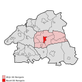
Skeda:Map - NL - Bronckhorst - Wijk 00 Hengelo - Buurt 00 Hengelo.svg

Page contents not supported in other languages.
Nga Wikipedia, enciklopedia e lirë

Dokument origjinal(skedë SVG, fillimisht 375 × 375 pixel, madhësia e skedës: 54 KB)

Kjo skedë është prej Wikimedia Commons dhe mund të përdoret nga projekte të tjera. Përshkrimi në këtë skedë në këtë faqe nuk është treguar më poshtë. Shko tek faqja përshkruese në Commons Shko tek faqja përshkruese në Commons

Përshkrimi
  • Map - NL - Bronckhorst - Wijk 00 Hengelo - Buurt 00 Hengelo.svg
  • locator map showing municipality boundary (2009) and statistical district/neighbourhood boundaries according to CBS
  • Numbering and names of neighboorhoods as defined by CBS in the 2008 Esri publication brt_2008_gen.shp
  • This SVG was generated with a script
Data
Burimi own work using free available sources
Autori

Michiel1972,

© Krijuesi i kësaj skede, Centraal Bureau voor de Statistiek, lejon këdo ta përdorë për çdo qëllim, me kusht që krijuesi është i atribuar si duhet. Rishpërndarja, puna derivative, përdorimi komercial, dhe të gjitha përdorimet janë të lejuara.
Atribuim:
Bron: © 2008, Centraal Bureau voor de Statistiek / Topografische Dienst Kadaster

VRT Wikimedia

This work is free and may be used by anyone for any purpose. If you wish to use this content, you do not need to request permission as long as you follow any licensing requirements mentioned on this page.

The Wikimedia Foundation has received an e-mail confirming that the copyright holder has approved publication under the terms mentioned on this page. This correspondence has been reviewed by a Volunteer Response Team (VRT) member and stored in our permission archive. The correspondence is available to trusted volunteers as ticket #2007041210008226.

If you have questions about the archived correspondence, please use the VRT noticeboard. Ticket link: https://ticket.wikimedia.org/otrs/index.pl?Action=AgentTicketZoom&TicketNumber=2007041210008226
Find other files from the same ticket: SDC query (SPARQL)

Leja
(Ripërdor këtë skedë)
Attribution ShareAlike 3.0
w:sq:Creative Commons
atribuim share alike
Je i lirë të:
  • ta shpërndani – ta kopjoni, rishpërndani dhe përcillni punën
  • t’i bëni “remix” – të përshtatni punën
Sipas kushteve të mëposhtme:
  • atribuim – Duhet t’i jepni meritat e duhura, të siguroni një lidhje për tek licenca dhe të tregoni nëse janë bërë ndryshime. Këtë mund ta bëni në ndonjë mënyrë të arsyeshme, por jo në ndonjë mënyrë që sugjeron se licencuesi ju del zot juve apo përdorimit tuaj.
  • share alike – Nëse bëni një “remix”, e shndërroni, ose ndërtoni duke u bazuar te materiali, duhet t’i shpërndani kontributet tuaja sipas të njëjtës licencë ose një të tille të përputhshme me origjinalen.

Captions

Add a one-line explanation of what this file represents

Items portrayed in this file

përshkruan

mars 2009

Historiku skedës

Shtypni mbi një datë/kohë për ta parë skedën siç ishte atëherë.

Data/KohaMiniaturëPërmasatPërdoruesiKoment
e tanishme24 prill 2009 22:17Miniaturë për versionin duke filluar nga 24 prill 2009 22:17375 × 375 (54 KB)Michiel1972{{Information |Description=<!--correct utf8, ALSO show buurt boundaries outside the "wijk" of the shown "buurt" --> |Source=own work, using free available sources |Date= |Author=Michiel1972, {{Attribution|nolink=[http://www.cbs.nl Centraal Bureau voor de
21 mars 2009 18:27Miniaturë për versionin duke filluar nga 21 mars 2009 18:27375 × 375 (29 KB)Michiel1972{{Information |Description=*{{subst:PAGENAME}} *locator map showing municipality boundary (2009) and statistical district/neighbourhood boundaries according to CBS *Numbering and names of neighboorhoods as defined by CBS in the 2008 Esri publication brt_2

S’ka faqe që përdorin këtë kartelë.

Përdorimi global i skedës

Kjo skedë përdoret nga Wiki të tjera në vijim: