
Skeda:Map of Brunei Demis.png
Madhësia e këtij shikimi: 527 × 599 pixel. Rezolucione të tjera: 211 × 240 pixel | 422 × 480 pixel | 938 × 1.066 pixel.
Dokument origjinal ((përmasa 938 × 1.066 px, madhësia skedës: 238 KB, lloji MIME: image/png))
| Kjo skedë është prej Wikimedia Commons dhe mund të përdoret nga projekte të tjera. Përshkrimi në këtë skedë në këtë faqe nuk është treguar më poshtë. | Shko tek faqja përshkruese në Commons |
Përmbledhje
| Përshkrimi |
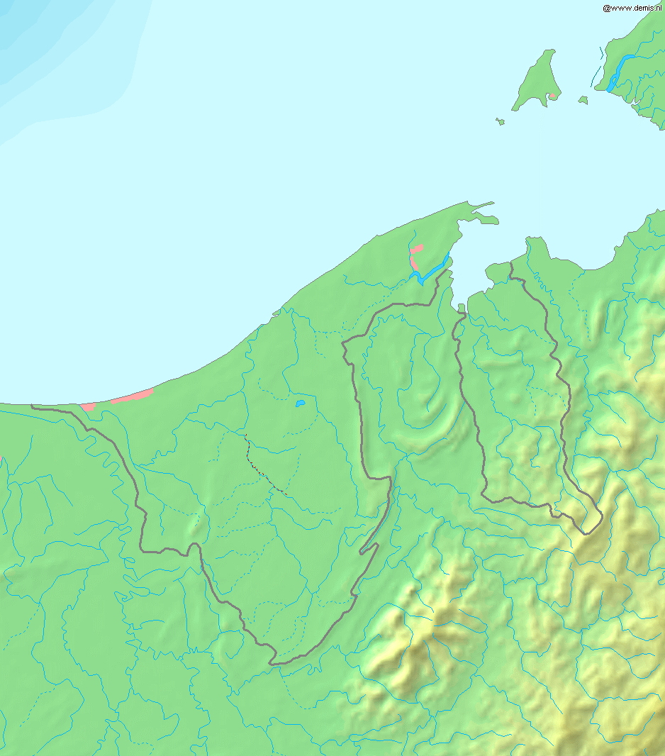
Deutsch: Topografische Karte von Brunei. Quadratische Plattkarte, Zentrum: 4°39′00″N 114°45′00″E / 4.65000°N 114.75000°E. Geographische Begrenzung der Karte:
English: Blank relief map of Brunei. Equirectangular projection centered at 4°39′00″N 114°45′00″E / 4.65000°N 114.75000°E. Geographic limits of the map:
Français : Carte du relief vierge du Brunei. Projection équirectangulaire centrée en 4°39′00″N 114°45′00″E / 4.65000°N 114.75000°E. Limites géographiques de la carte :
|
| Data | |
| Burimi | Punë e juaja, using Demis data |
| Autori | Mats Halldin (talk) |
Licencim
This image is in the public domain because it came from the site https://www.demis.nl/products/web-map-server/examples/ and was released by the copyright holder. Permission is granted to copy, distribute and/or modify this map since it is based on free of copyright images from: www.demis.nl. See also approval email on de.wp and its clarification.
|
| This work has been released into the public domain by its copyright holder, www.demis.nl. This applies worldwide. Në disa vende kjo mund të mos jetë e mundur ligjërisht; nëse është kështu: www.demis.nl i garanton çdokujt të drejtën për ta përdorur këtë punë për çdo qëllim, pa asnjë kusht, përveç rasteve kur këto kushte janë të kërkuara nga ligji.
|
Historiku skedës
Shtypni mbi një datë/kohë për ta parë skedën siç ishte atëherë.
| Data/Koha | Miniaturë | Përmasat | Përdoruesi | Koment | |
|---|---|---|---|---|---|
| e tanishme | 20 dhjetor 2006 20:11 | | 938 × 1.066 (238 KB) | Mats Halldin~commonswiki | Map of Brunei Bounding box West 114°, South 3.8°, East 115.5°, North 5.5°. Center at {{coor d|4.65000|N|114.75000|E|scale:1020000}}. {{demis-pd}} Category:Maps of Brunei |
Lidhje skedash
Këto faqe lidhen tek kjo skedë:
Përdorimi global i skedës
Kjo skedë përdoret nga Wiki të tjera në vijim:
- Përdorimi në ar.wikipedia.org
- Përdorimi në az.wikipedia.org
- Përdorimi në bg.wikipedia.org
- Përdorimi në ca.wikipedia.org
- Përdorimi në en.wikipedia.org
- Përdorimi në ja.wikipedia.org
- Përdorimi në la.wikipedia.org
- Përdorimi në ms.wikipedia.org
- Përdorimi në pt.wikipedia.org
- Përdorimi në te.wikipedia.org
- Përdorimi në th.wikipedia.org
- Përdorimi në uk.wikipedia.org
- Përdorimi në vep.wikipedia.org
- Përdorimi në zh-yue.wikipedia.org
- Përdorimi në zh.wikipedia.org