
Skeda:Map of California highlighting Calaveras County.svg

Size of this PNG preview of this SVG file: 523 × 599 pixel. Rezolucione të tjera: 209 × 240 pixel | 419 × 480 pixel | 670 × 768 pixel | 894 × 1.024 pixel | 1.787 × 2.048 pixel | 1.022 × 1.171 pixel.
Dokument origjinal (skedë SVG, fillimisht 1.022 × 1.171 pixel, madhësia e skedës: 496 KB)
| Kjo skedë është prej Wikimedia Commons dhe mund të përdoret nga projekte të tjera. Përshkrimi në këtë skedë në këtë faqe nuk është treguar më poshtë. | Shko tek faqja përshkruese në Commons |
Përmbledhje
| Përshkrimi |
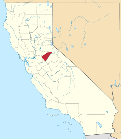
English: This is a locator map showing Calaveras County in California. For more information, see Commons:United States county locator maps. |
| Data | |
| Burimi |
Punë e juaja: English: The maps use data from nationalatlas.gov, specifically countyp020.tar.gz on the Raw Data Download page. The maps also use state outline data from statesp020.tar.gz. The Florida maps use hydrogm020.tar.gz to display Lake Okeechobee. |
| Autori | David Benbennick |
Licencim
| Unë,krijuesi i kësaj pune, e lëshoj këtë punë në public domain. Kjo aplikohet në të gjithë botën. Në disa vende kjo mund të mos jetë e mundur ligjërisht; nëse është kështu: Unë i garantoj çdokujt të drejtën për ta përdorur këtë punë për çdo qëllim, pa asnjë kusht, përveç rasteve kur këto kushte janë të kërkuara nga ligji. |
Historiku skedës
Shtypni mbi një datë/kohë për ta parë skedën siç ishte atëherë.
| Data/Koha | Miniaturë | Përmasat | Përdoruesi | Koment | |
|---|---|---|---|---|---|
| e tanishme | 26 nëntor 2016 18:16 | | 1.022 × 1.171 (496 KB) | Spartan7W | Update HQ map |
| 12 shkurt 2006 12:25 |  | 9.164 × 10.536 (229 KB) | David Benbennick | {{subst:User:Dbenbenn/clm|county=Calaveras County|state=California}} |
Lidhje skedash
S’ka faqe që përdorin këtë kartelë.
Përdorimi global i skedës
Kjo skedë përdoret nga Wiki të tjera në vijim:
- Përdorimi në ar.wikipedia.org
- مقاطعة كالافيراس (كاليفورنيا)
- أنجلس كامب (كاليفورنيا)
- فالي سبرينغز (كاليفورنيا)
- فورست ميدوز (كاليفورنيا)
- والاس (كاليفورنيا)
- سان أندرياس (كاليفورنيا)
- أرنولد (كاليفورنيا)
- أفيري (كاليفورنيا)
- رانتشو كالافيراس (كاليفورنيا)
- ويست بوينت (كاليفورنيا)
- قالب:مقاطعة كالافيراس (كاليفورنيا)
- كوبروبوليس (كاليفورنيا)
- Përdorimi në az.wikipedia.org
- Përdorimi në ban.wikipedia.org
- Përdorimi në bpy.wikipedia.org
- Përdorimi në ca.wikipedia.org
- Angels Camp
- Arnold (Califòrnia)
- Avery (Califòrnia)
- Copperopolis
- Dorrington
- Forest Meadows
- Mokelumne Hill
- Mountain Ranch
- Murphys
- Rail Road Flat
- Rancho Calaveras
- San Andreas (Califòrnia)
- Vallecito
- Valley Springs (Califòrnia)
- Wallace (Califòrnia)
- West Point (Califòrnia)
- Plantilla:Comtat de Calaveras
- Llista de comtats de Califòrnia
- Përdorimi në ceb.wikipedia.org
- Përdorimi në ce.wikipedia.org
- Përdorimi në ckb.wikipedia.org
- Përdorimi në cs.wikipedia.org
- Përdorimi në cy.wikipedia.org
- Përdorimi në da.wikipedia.org
- Përdorimi në de.wikipedia.org
- Përdorimi në en.wikipedia.org
Shikoni më shumë përdorim global të kësaj skede.