
Skeda:Palestine according to Eusbius and Jerome - Smith 1915.jpg

Madhësia e këtij shikimi: 363 × 599 pixel. Rezolucione të tjera: 145 × 240 pixel | 291 × 480 pixel | 465 × 768 pixel | 620 × 1.024 pixel | 2.416 × 3.987 pixel.
Dokument origjinal ((përmasa 2.416 × 3.987 px, madhësia skedës: 5,55 MB, lloji MIME: image/jpeg))
| Kjo skedë është prej Wikimedia Commons dhe mund të përdoret nga projekte të tjera. Përshkrimi në këtë skedë në këtë faqe nuk është treguar më poshtë. | Shko tek faqja përshkruese në Commons |
Përmbledhje
| Përshkrimi |
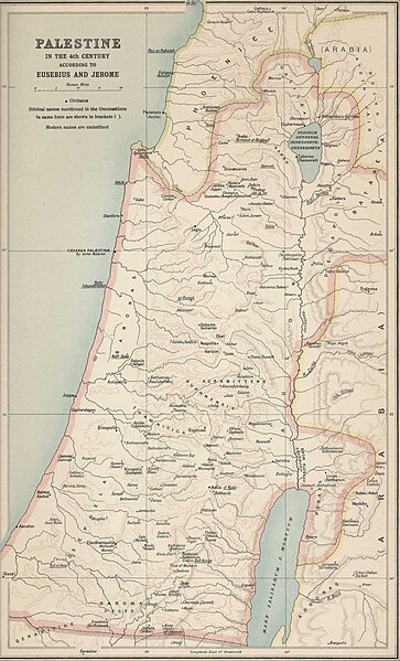
English: Palestine according to Eusbius and Jerome, as per Atlas of the Historical Geography of the Holy Land by George Adam Smith in 1915 |
| Data | |
| Burimi | |
| Autori | George Adam Smith |
.jpg)
Licencim
This media file is in the public domain in the United States. This applies to U.S. works where the copyright has expired, often because its first publication occurred prior to January 1, 1929, and if not then due to lack of notice or renewal. See this page for further explanation.
|
 | |
 |
This image might not be in the public domain outside of the United States; this especially applies in the countries and areas that do not apply the rule of the shorter term for US works, such as Canada, Mainland China (not Hong Kong or Macao), Germany, Mexico, and Switzerland. The creator and year of publication are essential information and must be provided. See Wikipedia:Public domain and Wikipedia:Copyrights for more details.
|
Historiku skedës
Shtypni mbi një datë/kohë për ta parë skedën siç ishte atëherë.
| Data/Koha | Miniaturë | Përmasat | Përdoruesi | Koment | |
|---|---|---|---|---|---|
| e tanishme | 24 dhjetor 2023 10:03 | | 2.416 × 3.987 (5,55 MB) | DEGA MD | Higher resolution version of the same map. |
| 7 gusht 2012 16:02 |  | 559 × 925 (126 KB) | Onceinawhile |
Lidhje skedash
S’ka faqe që përdorin këtë kartelë.
Përdorimi global i skedës
Kjo skedë përdoret nga Wiki të tjera në vijim:
- Përdorimi në ace.wikipedia.org
- Përdorimi në anp.wikipedia.org
- Përdorimi në ar.wikipedia.org
- Përdorimi në az.wikipedia.org
- Përdorimi në bn.wikipedia.org
- Përdorimi në crh.wikipedia.org
- Përdorimi në da.wikipedia.org
- Përdorimi në de.wikipedia.org
- Përdorimi në diq.wikipedia.org
- Përdorimi në el.wikipedia.org
- Përdorimi në en.wikipedia.org
- Përdorimi në es.wikipedia.org
- Përdorimi në et.wikipedia.org
- Përdorimi në eu.wikipedia.org
- Përdorimi në fa.wikipedia.org
- Përdorimi në fr.wikipedia.org
- Përdorimi në gag.wikipedia.org
- Përdorimi në he.wikipedia.org
- Përdorimi në hi.wikipedia.org
- Përdorimi në hr.wikipedia.org
- Përdorimi në hsb.wikipedia.org
- Përdorimi në hu.wikipedia.org
- Përdorimi në hy.wikipedia.org
- Përdorimi në hyw.wikipedia.org
- Përdorimi në id.wikipedia.org
- Përdorimi në is.wikipedia.org
- Përdorimi në kg.wikipedia.org
- Përdorimi në kk.wikipedia.org
- Përdorimi në lad.wikipedia.org
- Përdorimi në lij.wikipedia.org
- Përdorimi në lv.wikipedia.org
- Përdorimi në nl.wikipedia.org
- Përdorimi në pl.wikipedia.org
- Përdorimi në pnb.wikipedia.org
- Përdorimi në pt.wikipedia.org
Shikoni më shumë përdorim global të kësaj skede.