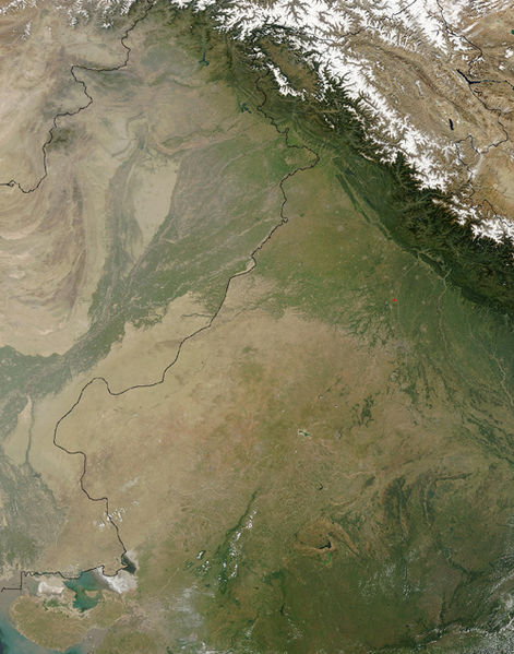
Skeda:Thar Desert satellite.jpg

Madhësia e këtij shikimi: 471 × 599 pixel. Rezolucione të tjera: 189 × 240 pixel | 500 × 636 pixel.
Dokument origjinal ((përmasa 500 × 636 px, madhësia skedës: 329 KB, lloji MIME: image/jpeg))
Historiku skedës
Shtypni mbi një datë/kohë për ta parë skedën siç ishte atëherë.
| Data/Koha | Miniaturë | Përmasat | Përdoruesi | Koment | |
|---|---|---|---|---|---|
| e tanishme | 17 shtator 2005 16:25 |  | 500 × 636 (329 KB) | Crux | Satellite Image of Thar Desert, India/Pakistan (border line in the middle) from en:, uploaded by en:User:Tom Radulovich |
Lidhje skedash
Këto faqe lidhen tek kjo skedë:
Përdorimi global i skedës
Kjo skedë përdoret nga Wiki të tjera në vijim:
- Përdorimi në ar.wikipedia.org
- Përdorimi në az.wikipedia.org
- Përdorimi në bg.wikipedia.org
- Përdorimi në bn.wikipedia.org
- Përdorimi në bs.wikipedia.org
- Përdorimi në ckb.wikipedia.org
- Përdorimi në de.wikipedia.org
- Përdorimi në en.wikipedia.org
- Përdorimi në eo.wikipedia.org
- Përdorimi në es.wikipedia.org
- Përdorimi në et.wikipedia.org
- Përdorimi në fa.wikipedia.org
- Përdorimi në fi.wikipedia.org
- Përdorimi në fr.wikipedia.org
- Përdorimi në he.wikipedia.org
- Përdorimi në hu.wikipedia.org
- Përdorimi në it.wikipedia.org
- Përdorimi në ja.wikipedia.org
- Përdorimi në ka.wikipedia.org
- Përdorimi në kk.wikipedia.org
- Përdorimi në kn.wikipedia.org
- Përdorimi në ko.wikipedia.org
- Përdorimi në ky.wikipedia.org
- Përdorimi në lfn.wikipedia.org
- Përdorimi në lt.wikipedia.org
- Përdorimi në mai.wikipedia.org
- Përdorimi në mg.wikipedia.org
- Përdorimi në mk.wikipedia.org
- Përdorimi në ml.wikipedia.org
- Përdorimi në mr.wikipedia.org
- Përdorimi në ms.wikipedia.org
- Përdorimi në ne.wikipedia.org
- Përdorimi në nn.wikipedia.org
- Përdorimi në pa.wikipedia.org
- Përdorimi në pl.wikipedia.org
- Përdorimi në pnb.wikipedia.org
Shikoni më shumë përdorim global të kësaj skede.


