
Skeda:USATopographicalMap.jpg
Madhësia e këtij shikimi: 800 × 527 pixel. Rezolucione të tjera: 320 × 211 pixel | 640 × 422 pixel | 1.024 × 674 pixel | 1.280 × 843 pixel | 2.560 × 1.686 pixel | 3.199 × 2.107 pixel.
Dokument origjinal ((përmasa 3.199 × 2.107 px, madhësia skedës: 11,19 MB, lloji MIME: image/jpeg))
| Kjo skedë është prej Wikimedia Commons dhe mund të përdoret nga projekte të tjera. Përshkrimi në këtë skedë në këtë faqe nuk është treguar më poshtë. | Shko tek faqja përshkruese në Commons |
Përmbledhje
| Përshkrimi |
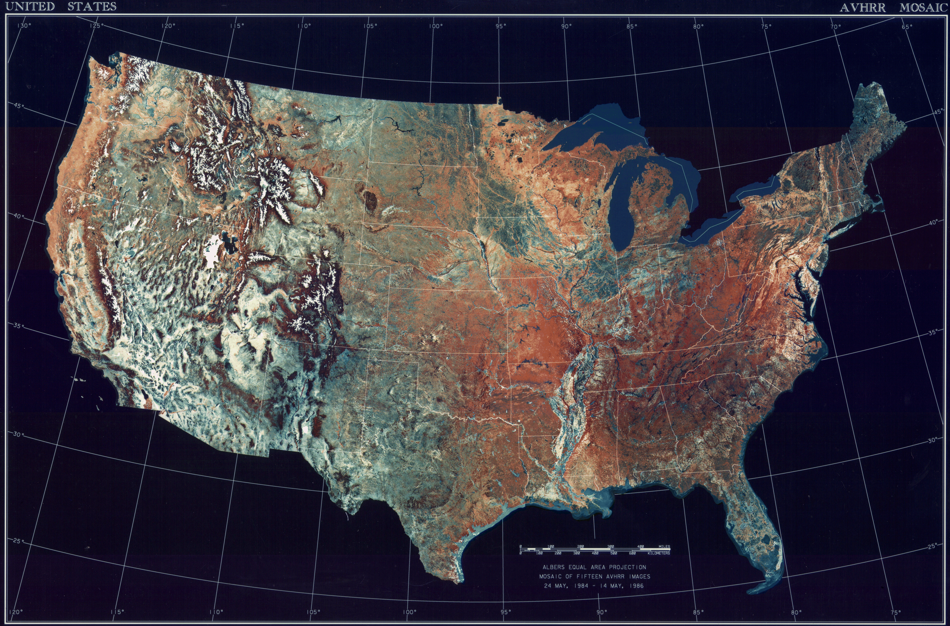
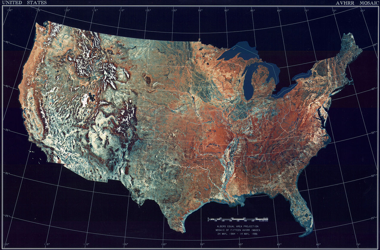
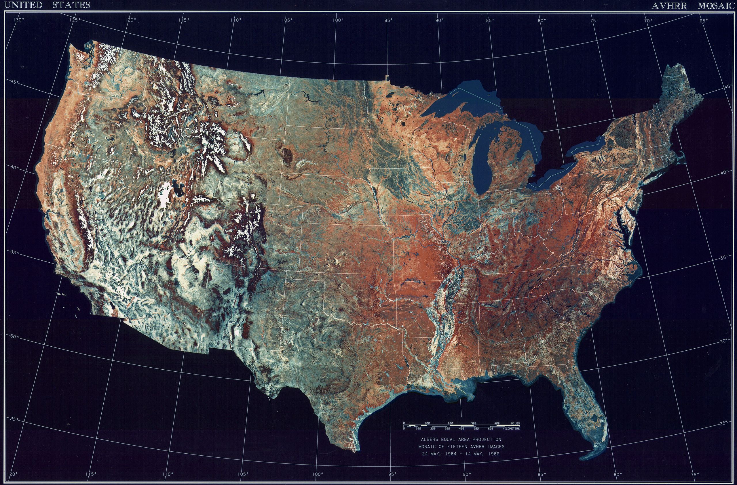
Deutsch: Satellitenbild der 48 Zentralstaaten der Vereinigten Staaten.
|
| Data | 24 maj 1984 - 14 maj 1986 |
| Burimi | National Climactic Data Center/NOAA Satellite and Information Service |
| Autori | U.S. Dept. of Commerce/National Climactic Data Center/NOAA Satellite and Information Service |
Licencim
This image is in the public domain because it contains materials that originally came from the U.S. National Oceanic and Atmospheric Administration, taken or made as part of an employee's official duties.
|
Historiku skedës
Shtypni mbi një datë/kohë për ta parë skedën siç ishte atëherë.
| Data/Koha | Miniaturë | Përmasat | Përdoruesi | Koment | |
|---|---|---|---|---|---|
| e tanishme | 25 tetor 2013 10:06 | | 3.199 × 2.107 (11,19 MB) | McZusatz | compression (uploaded using chunked upload script) |
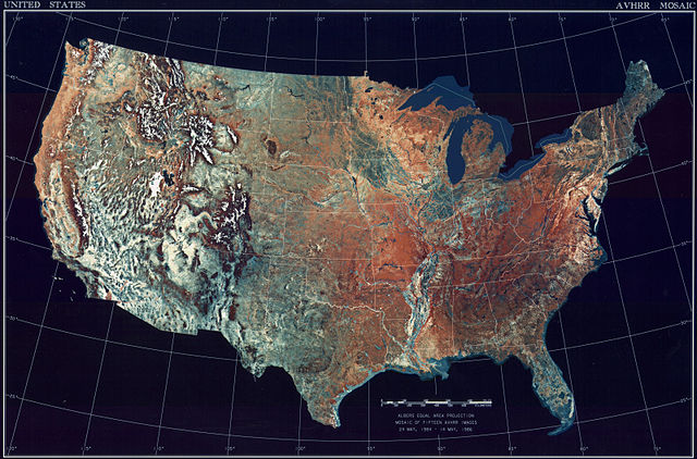
| 4 mars 2009 19:33 |  | 3.199 × 2.107 (450 KB) | File Upload Bot (Magnus Manske) | {{BotMoveToCommons|en.wikipedia|year={{subst:CURRENTYEAR}}|month={{subst:CURRENTMONTHNAME}}|day={{subst:CURRENTDAY}}}} {{Information |Description={{en|Topographical map of the United States}} |Source=Transferred from [http://en.wikipedia.org en.wikipedia |
Lidhje skedash
Këto faqe lidhen tek kjo skedë:
Përdorimi global i skedës
Kjo skedë përdoret nga Wiki të tjera në vijim:
- Përdorimi në ar.wikipedia.org
- Përdorimi në arz.wikipedia.org
- Përdorimi në ceb.wikipedia.org
- Përdorimi në de.wikipedia.org
- Përdorimi në el.wikipedia.org
- Përdorimi në en.wikipedia.org
- Përdorimi në es.wikipedia.org
- Përdorimi në fa.wikipedia.org
- Përdorimi në fr.wikipedia.org
- Përdorimi në fy.wikipedia.org
- Përdorimi në gu.wikipedia.org
- Përdorimi në he.wikipedia.org
- Përdorimi në ia.wikipedia.org
- Përdorimi në incubator.wikimedia.org
- Përdorimi në kn.wikipedia.org
- Përdorimi në la.wikipedia.org
- Përdorimi në lt.wikipedia.org
- Përdorimi në mnw.wikipedia.org
- Përdorimi në ms.wikipedia.org
- Përdorimi në my.wikipedia.org
- Përdorimi në pap.wikipedia.org
- Përdorimi në sv.wikipedia.org
- Përdorimi në sw.wikipedia.org
- Përdorimi në ta.wikipedia.org
- Përdorimi në tcy.wikipedia.org
- Përdorimi në th.wikipedia.org
- Përdorimi në tl.wikipedia.org
- Përdorimi në uk.wikipedia.org
- Përdorimi në www.wikidata.org
- Përdorimi në yo.wikipedia.org