
Skeda:1154 Tabula Rogeriana noroeste Peninsula Iberica Al Idrisi copia mas antigua.jpg
Madhësia e këtij shikimi: 800 × 539 pixel. Rezolucione të tjera: 320 × 215 pixel | 640 × 431 pixel | 1.024 × 689 pixel | 1.280 × 862 pixel | 2.560 × 1.723 pixel | 4.800 × 3.231 pixel.
Dokument origjinal ((përmasa 4.800 × 3.231 px, madhësia skedës: 6,31 MB, lloji MIME: image/jpeg))
| Kjo skedë është prej Wikimedia Commons dhe mund të përdoret nga projekte të tjera. Përshkrimi në këtë skedë në këtë faqe nuk është treguar më poshtë. | Shko tek faqja përshkruese në Commons |
Përmbledhje
| Përshkrimi |
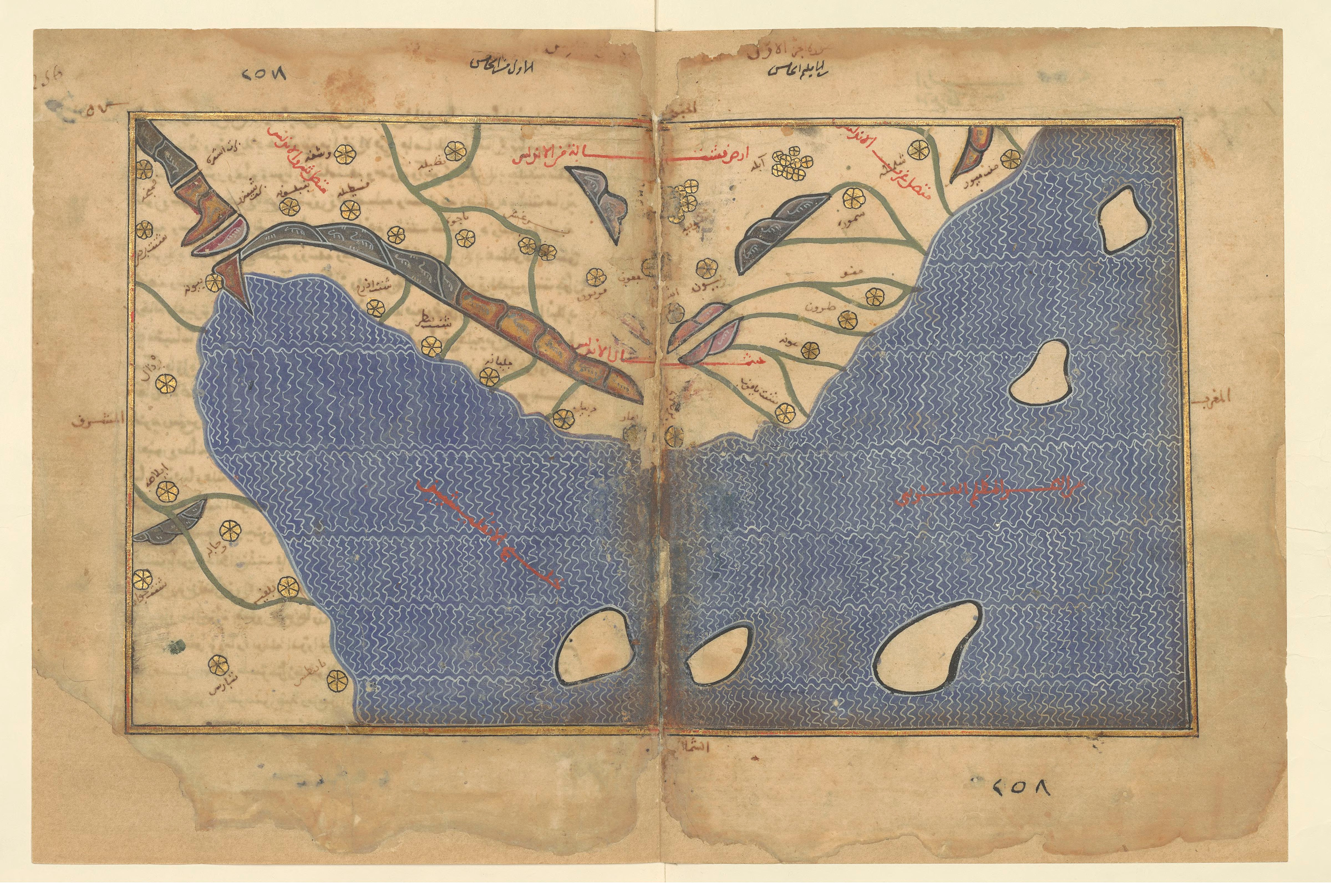
Galego: Mapa datado circa 1300 d. C. e conservado en París. É a copia máis vella que se conserva da Tábula Rogeriana orixinal de Al Idrisi do 1154 d. C. Preséntanse dúas versións: unha orientada co norte arriba e outra co sur arriba. |
||
| Data | |||
| Burimi |
|
||
| Autori | Al Idrisi | ||
| Versione tjera |
|
_(original,_1154;_c%C3%B3pia,_c._1300).jpg)
_(original,_1154;_c%C3%B3pia,_c._1300).jpg)
.jpg)

Licencim
|
This is a faithful photographic reproduction of a two-dimensional, public domain work of art. The work of art itself is in the public domain for the following reason:
The official position taken by the Wikimedia Foundation is that "faithful reproductions of two-dimensional public domain works of art are public domain".
This photographic reproduction is therefore also considered to be in the public domain in the United States. In other jurisdictions, re-use of this content may be restricted; see Reuse of PD-Art photographs for details. | ||||
Historiku skedës
Shtypni mbi një datë/kohë për ta parë skedën siç ishte atëherë.
| Data/Koha | Miniaturë | Përmasat | Përdoruesi | Koment | |
|---|---|---|---|---|---|
| e tanishme | 19 tetor 2019 16:15 | | 4.800 × 3.231 (6,31 MB) | One2 | better |
| 9 gusht 2010 11:12 |  | 600 × 401 (50 KB) | Hermericus | ||
| 4 gusht 2010 00:31 |  | 633 × 406 (161 KB) | Hermericus | {{Information |Description=Mapa datado circa 1300 d.C. É a copia máis vella que se conserva da Tábula Rogeriana orixinal de Al Idrisi do 1154 d.C. |Source=Biblioteca Nacional de Francia |Author=Al Idrisi |Date=1154 d.C. |Permission= |other_versions= }} |
Lidhje skedash
Këto faqe lidhen tek kjo skedë:
Përdorimi global i skedës
Kjo skedë përdoret nga Wiki të tjera në vijim:
- Përdorimi në bg.wikipedia.org
- Përdorimi në en.wikipedia.org
- Përdorimi në it.wikipedia.org
- Përdorimi në kn.wikipedia.org
- Përdorimi në mt.wikipedia.org
- Përdorimi në su.wikipedia.org
- Përdorimi në th.wikipedia.org
- Përdorimi në xmf.wikipedia.org