
Skeda:Fires and Deforestation on the Amazon Frontier, Rondonia, Brazil - August 12, 2007.jpg

Madhësia e këtij shikimi: 767 × 600 pixel. Rezolucione të tjera: 307 × 240 pixel | 614 × 480 pixel | 982 × 768 pixel | 1.280 × 1.001 pixel | 2.560 × 2.002 pixel | 3.836 × 3.000 pixel.
Dokument origjinal ((përmasa 3.836 × 3.000 px, madhësia skedës: 2,88 MB, lloji MIME: image/jpeg))
| Kjo skedë është prej Wikimedia Commons dhe mund të përdoret nga projekte të tjera. Përshkrimi në këtë skedë në këtë faqe nuk është treguar më poshtë. | Shko tek faqja përshkruese në Commons |
Përmbledhje
| Përshkrimi |
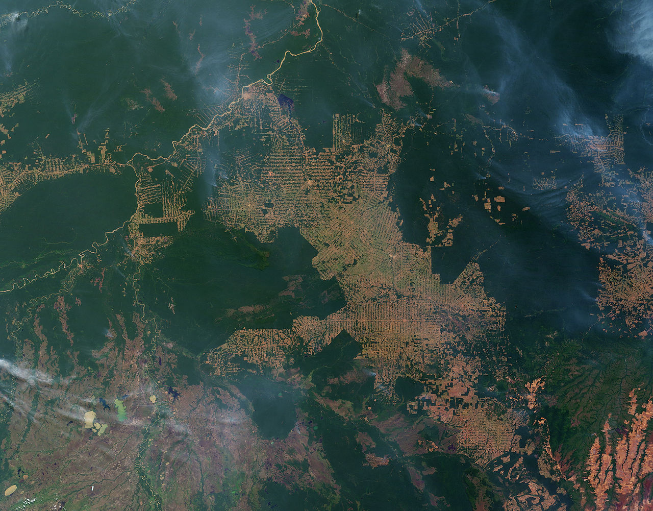
English: In this image, intact forest is deep green, while cleared areas are tan (bare ground) or light green (crops, pasture, or occasionally, second-growth forest). The fish bone pattern of small clearings along new roads is the beginning of one of the common deforestation trajectories in the Amazon. |
| Data | |
| Burimi | NASA Earth Observatory |
| Autori | Jesse Allen and Robert Simmon |
| Versione tjera |
|

Image based on data from the MODIS science team.
Licencim
| This file is in the public domain in the United States because it was solely created by NASA. NASA copyright policy states that "NASA material is not protected by copyright unless noted". (See Template:PD-USGov, NASA copyright policy page or JPL Image Use Policy.) | ||
 |
Warnings:
|
Historiku skedës
Shtypni mbi një datë/kohë për ta parë skedën siç ishte atëherë.
| Data/Koha | Miniaturë | Përmasat | Përdoruesi | Koment | |
|---|---|---|---|---|---|
| e tanishme | 28 maj 2009 11:25 | | 3.836 × 3.000 (2,88 MB) | Originalwana | {{Information |Description={{en|1=In this image, intact forest is deep green, while cleared areas are tan (bare ground) or light green (crops, pasture, or occasionally, second-growth forest). The fish bone pattern of small clearings along new roads is the |
Lidhje skedash
Këto faqe lidhen tek kjo skedë:
Përdorimi global i skedës
Kjo skedë përdoret nga Wiki të tjera në vijim:
- Përdorimi në af.wikipedia.org
- Përdorimi në ar.wikipedia.org
- Përdorimi në az.wikipedia.org
- Përdorimi në bg.wikipedia.org
- Përdorimi në cs.wikipedia.org
- Përdorimi në en.wikipedia.org
- Përdorimi në eo.wikipedia.org
- Përdorimi në es.wikipedia.org
- Përdorimi në fa.wikipedia.org
- Përdorimi në kn.wikipedia.org
- Përdorimi në mk.wikipedia.org
- Përdorimi në nl.wikipedia.org
- Përdorimi në nn.wikipedia.org
- Përdorimi në pt.wikipedia.org
- Përdorimi në pt.wikinews.org
- Përdorimi në sl.wikipedia.org
- Përdorimi në sr.wikinews.org
- Përdorimi në sw.wikipedia.org
- Përdorimi në tr.wikipedia.org