
Skeda:Indiana county map.png
Madhësia e këtij shikimi: 507 × 599 pixel. Rezolucione të tjera: 203 × 240 pixel | 406 × 480 pixel | 732 × 865 pixel.
Dokument origjinal ((përmasa 732 × 865 px, madhësia skedës: 97 KB, lloji MIME: image/png))
| Kjo skedë është prej Wikimedia Commons dhe mund të përdoret nga projekte të tjera. Përshkrimi në këtë skedë në këtë faqe nuk është treguar më poshtë. | Shko tek faqja përshkruese në Commons |

|
Kjo locator map fotografi duhet duhen te behen edhe i here si nje SVG.
|
Përmbledhje
| Përshkrimi |
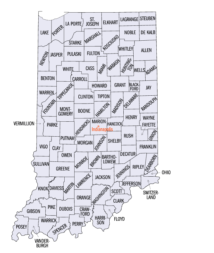
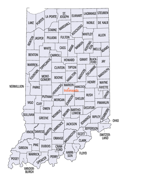
English: Map of from the Census Bureau |
| Burimi | http://quickfacts.census.gov/qfd/maps/indiana_map.html |
| Autori | US Census Bureau |
Licencim
This work is in the public domain in the United States because it is a work prepared by an officer or employee of the United States Government as part of that person’s official duties under the terms of Title 17, Chapter 1, Section 105 of the US Code.
Note: This only applies to original works of the Federal Government and not to the work of any individual U.S. state, territory, commonwealth, county, municipality, or any other subdivision. This template also does not apply to postage stamp designs published by the United States Postal Service since 1978. (See § 313.6(C)(1) of Compendium of U.S. Copyright Office Practices). It also does not apply to certain US coins; see The US Mint Terms of Use.
|
 | |
| Kjo skedë është identifikuar si e lirë e kufizimeve të panjohura në ligjin e të drejtave të autorit, duke përfshirë të gjitha të drejtat e lidhura dhe fqinje. | ||
Historiku skedës
Shtypni mbi një datë/kohë për ta parë skedën siç ishte atëherë.
| Data/Koha | Miniaturë | Përmasat | Përdoruesi | Koment | |
|---|---|---|---|---|---|
| e tanishme | 31 maj 2009 18:49 | | 732 × 865 (97 KB) | Reywas92 | {{Information |Description={{en|1=Map of en:List of counties in Indiana from the Census Bureau}} |Source=http://quickfacts.census.gov/qfd/maps/indiana_map.html |Author=US Censis Bureau |Date= |Permission= |other_versions= }} <!--{{ImageUpload|full}}- |
Lidhje skedash
Këto faqe lidhen tek kjo skedë:
Përdorimi global i skedës
Kjo skedë përdoret nga Wiki të tjera në vijim:
- Përdorimi në cy.wikipedia.org
- Përdorimi në en.wikipedia.org
- Përdorimi në he.wikipedia.org
- Përdorimi në hu.wikipedia.org
- Përdorimi në ja.wikipedia.org
- Përdorimi në ko.wikipedia.org
- Përdorimi në pt.wikipedia.org
- Përdorimi në ru.wikipedia.org
- Përdorimi në simple.wikipedia.org
- Përdorimi në ur.wikipedia.org
- Përdorimi në www.wikidata.org