
Skeda:Satellite image of Andorra in March.jpg
Nuk ka përmasa më të madhaja.
Satellite_image_of_Andorra_in_March.jpg ((përmasa 126 × 110 px, madhësia skedës: 5 KB, lloji MIME: image/jpeg))
| Kjo skedë është prej Wikimedia Commons dhe mund të përdoret nga projekte të tjera. Përshkrimi në këtë skedë në këtë faqe nuk është treguar më poshtë. | Shko tek faqja përshkruese në Commons |
Përmbledhje
| Përshkrimi |
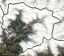
English: Cropped satellite image of Andorra in March, showing extensive snow cover. |
| Data | |
| Burimi | Cropped from original: http://visibleearth.nasa.gov/view_rec.php?id=5096 |
| Autori | Jeff Schmaltz, MODIS Rapid Response Team, NASA/GSFC |
| Versione tjera |
 |
Licencim
| This file is in the public domain in the United States because it was solely created by NASA. NASA copyright policy states that "NASA material is not protected by copyright unless noted". (See Template:PD-USGov, NASA copyright policy page or JPL Image Use Policy.) | ||
 |
Warnings:
|
Historiku skedës
Shtypni mbi një datë/kohë për ta parë skedën siç ishte atëherë.
| Data/Koha | Miniaturë | Përmasat | Përdoruesi | Koment | |
|---|---|---|---|---|---|
| e tanishme | 18 dhjetor 2004 16:00 | | 126 × 110 (5 KB) | Hautala | {{PD-USGov-NASA}} Satellite image of Andorra in March. Taken from NASA's Visible Earth http://visibleearth.nasa.gov/cgi-bin/viewrecord?25168 |
Lidhje skedash
Këto faqe lidhen tek kjo skedë:
Përdorimi global i skedës
Kjo skedë përdoret nga Wiki të tjera në vijim:
- Përdorimi në azb.wikipedia.org
- Përdorimi në bg.wiktionary.org
- Përdorimi në ca.wikipedia.org
- Përdorimi në cy.wikipedia.org
- Përdorimi në en.wiktionary.org
- Përdorimi në hif.wikipedia.org
- Përdorimi në hr.wikipedia.org
- Përdorimi në ia.wikipedia.org
- Përdorimi në nds.wikipedia.org
- Përdorimi në sh.wikipedia.org
- Përdorimi në simple.wikipedia.org
- Përdorimi në sk.wikipedia.org
- Përdorimi në sl.wikipedia.org
- Përdorimi në sw.wikipedia.org
- Përdorimi në zh-yue.wikipedia.org