
Skeda:90mile beach nz landsatimage.jpg

Madhësia e këtij shikimi: 800 × 593 pixel. Rezolucione të tjera: 320 × 237 pixel | 640 × 474 pixel | 1.024 × 758 pixel | 1.280 × 948 pixel.
Dokument origjinal ((përmasa 1.280 × 948 px, madhësia skedës: 101 KB, lloji MIME: image/jpeg))
| Kjo skedë është prej Wikimedia Commons dhe mund të përdoret nga projekte të tjera. Përshkrimi në këtë skedë në këtë faqe nuk është treguar më poshtë. | Shko tek faqja përshkruese në Commons |
Përmbledhje
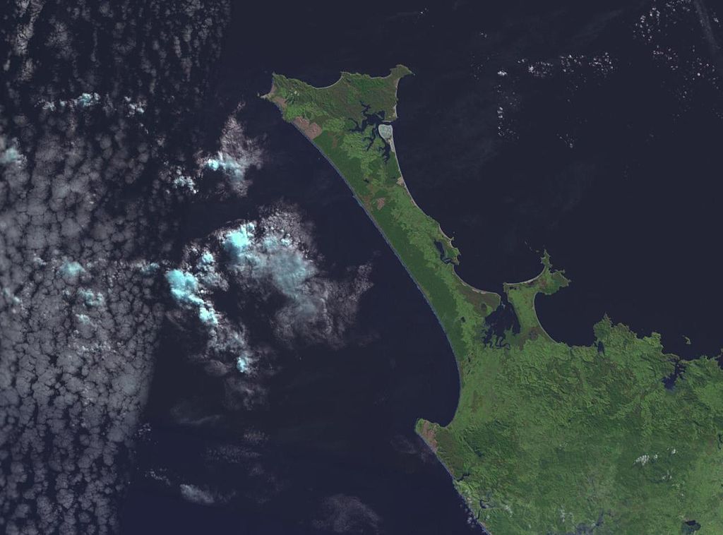
NASA World wind image of Aupouri Peninsula in New Zealand. Ninety Mile Beach, New Zealand is on the west (left) side of the peninsula.

Licencim
| This image is in the public domain because it is a screenshot from NASA’s globe software World Wind using a public domain layer, such as Blue Marble, MODIS, Landsat, SRTM, USGS or GLOBE.
|
 |
derivative works
Derivative works of this file: 90mile beach nz landsatimage crop.jpg
Historiku skedës
Shtypni mbi një datë/kohë për ta parë skedën siç ishte atëherë.
| Data/Koha | Miniaturë | Përmasat | Përdoruesi | Koment | |
|---|---|---|---|---|---|
| e tanishme | 1 shtator 2005 20:52 | | 1.280 × 948 (101 KB) | Klipp~commonswiki | NASA World wind image of Aupouri Peninsula in New Zealand. Ninety Mile Beach, New Zealand is on the west (left) side of the peninsula. |
Lidhje skedash
S’ka faqe që përdorin këtë kartelë.
Përdorimi global i skedës
Kjo skedë përdoret nga Wiki të tjera në vijim:
- Përdorimi në az.wikipedia.org
- Përdorimi në bn.wikipedia.org
- Përdorimi në ceb.wikipedia.org
- Përdorimi në cy.wikipedia.org
- Përdorimi në de.wikipedia.org
- Përdorimi në de.wikivoyage.org
- Përdorimi në en.wikipedia.org
- Përdorimi në en.wikivoyage.org
- Përdorimi në es.wikipedia.org
- Përdorimi në fr.wikipedia.org
- Përdorimi në he.wikipedia.org
- Përdorimi në id.wikipedia.org
- Përdorimi në it.wikipedia.org
- Përdorimi në ko.wikipedia.org
- Përdorimi në nn.wikipedia.org
- Përdorimi në no.wikipedia.org
- Përdorimi në pl.wikipedia.org
- Përdorimi në pt.wikipedia.org
- Përdorimi në ru.wikipedia.org
- Përdorimi në sv.wikipedia.org
- Përdorimi në www.wikidata.org