
Skeda:BlankEurope.png

Madhësia e këtij shikimi: 595 × 599 pixel. Rezolucione të tjera: 238 × 240 pixel | 477 × 480 pixel | 762 × 768 pixel | 1.236 × 1.245 pixel.
Dokument origjinal ((përmasa 1.236 × 1.245 px, madhësia skedës: 78 KB, lloji MIME: image/png))
| Kjo skedë është prej Wikimedia Commons dhe mund të përdoret nga projekte të tjera. Përshkrimi në këtë skedë në këtë faqe nuk është treguar më poshtë. | Shko tek faqja përshkruese në Commons |

|
File:Blank map of Europe (with disputed regions).svg is a vector version of this file. It should be used in place of this PNG file when not inferior.
File:BlankEurope.png → File:Blank map of Europe (with disputed regions).svg
For more information, see Help:SVG. |
.svg) |
Përmbledhje
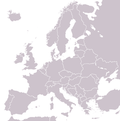
A blank political map of Europe extracted from Image:European Union member states by number of houses.png. +Hexagon1 (t) 04:47, 26 November 2006 (UTC)
Other versions: if you wish to use a map to show historical information before 2008, use Image:BlankEurope-BeforeKosovo.png
Licencim

|
Ju jepet leje për ta kopjuar, shpërndarë dhe/ose ndryshuar këtë dokument sipas kushteve të Licencës GNU për Dokumentim të Lirë, versioni 1.2 ose çfarëdo versioni të mëpasshëm të botuar nga Free Software Foundation; pa Seksione të Pandryshueshme, pa Tekste Kapakësh të Përparmë, dhe pa Tekste Kapakësh të Pasmë. Një kopje e kësaj licence është përfshirë në seksionin e titulluar GNU Free Documentation License. |
| Kjo skedë licencohet sipas Creative Commons Attribution-Share Alike 3.0 Unported. | ||
| ||
| Kjo etiketë licencimi u shtua te kjo skedë si pjesë e përditësimit të lincecimit. GFDL. |
Historiku skedës
Shtypni mbi një datë/kohë për ta parë skedën siç ishte atëherë.
| Data/Koha | Miniaturë | Përmasat | Përdoruesi | Koment | |
|---|---|---|---|---|---|
| e tanishme | 26 shtator 2022 15:31 | | 1.236 × 1.245 (78 KB) | BlackShadowG | Reverted to version as of 14:55, 27 October 2008 (UTC) |
| 24 shkurt 2009 00:40 |  | 1.236 × 1.245 (78 KB) | Avala | ||
| 27 tetor 2008 16:55 |  | 1.236 × 1.245 (78 KB) | Quilbert | Reverted to version as of 05:53, 5 April 2008 – there is already Image:BlankEurope-BeforeKosovo.png | |
| 24 tetor 2008 20:13 |  | 1.236 × 1.245 (78 KB) | Avala | ||
| 5 prill 2008 07:53 |  | 1.236 × 1.245 (78 KB) | Hoshie | redid microstates, beefed up Spanish N. Africa, SBAs, and Gibraltar | |
| 25 shkurt 2008 20:42 |  | 1.236 × 1.245 (78 KB) | Hoshie | fixed Gibraltar, Ceuta and Melilla, and the SBAs | |
| 24 shkurt 2008 04:39 |  | 1.236 × 1.245 (78 KB) | Hoshie | Added Kosovo since it has been internationally recognized | |
| 4 janar 2008 00:40 |  | 1.236 × 1.245 (78 KB) | Hoshie | Re-drew ESBA and WSBA with circles until I study the CIA maps, boundary between Gibraltar and Spain. | |
| 26 nëntor 2006 06:47 |  | 1.236 × 1.245 (44 KB) | Happenstance | A blank map of Europe extracted from Image:European Union member states by number of houses.png. ~~~~ |
Lidhje skedash
S’ka faqe që përdorin këtë kartelë.
Përdorimi global i skedës
Kjo skedë përdoret nga Wiki të tjera në vijim:
- Përdorimi në de.wiktionary.org
- Përdorimi në hu.wikipedia.org
- Përdorimi në incubator.wikimedia.org
- Përdorimi në it.wiktionary.org
- Përdorimi në sl.wiktionary.org
- Përdorimi në uk.wikipedia.org