
Skeda:Brobdingnag map.jpg

Nuk ka përmasa më të madhaja.
Brobdingnag_map.jpg ((përmasa 386 × 600 px, madhësia skedës: 35 KB, lloji MIME: image/jpeg))
| Kjo skedë është prej Wikimedia Commons dhe mund të përdoret nga projekte të tjera. Përshkrimi në këtë skedë në këtë faqe nuk është treguar më poshtë. | Shko tek faqja përshkruese në Commons |
| Përshkrimi |
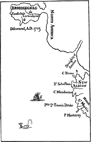
English: Map of Brobdingnag, for the 1726 edition of Jonathan Swift's Gulliver's Travels (or Travels into several remote nations of the world) |
||||
| Data | |||||
| Burimi | http://www.gutenberg.org/files/17157/17157-h/images/map02.jpg | ||||
| Autori | Benjamin Motte, printer, after the style of Herman Moll | ||||
| Leja (Ripërdor këtë skedë) |
|
||||
Historiku skedës
Shtypni mbi një datë/kohë për ta parë skedën siç ishte atëherë.
| Data/Koha | Miniaturë | Përmasat | Përdoruesi | Koment | |
|---|---|---|---|---|---|
| e tanishme | 20 shkurt 2009 08:55 | | 386 × 600 (35 KB) | Goustien | {{Information |Description={{en|1=Hermann Moll: ''Map of Brobdingnag'', for the 1726 edition of Jonathan Swift's ''Lemuel Gulliver's travels into several remote nations of the world'' }} |Source=http://www.gutenberg.org/files/17157/17157-h |
Lidhje skedash
S’ka faqe që përdorin këtë kartelë.
Përdorimi global i skedës
Kjo skedë përdoret nga Wiki të tjera në vijim:
- Përdorimi në en.wikipedia.org
- Përdorimi në eo.wikipedia.org
- Përdorimi në es.wikipedia.org
- Përdorimi në fr.wikipedia.org
- Përdorimi në hr.wikipedia.org
- Përdorimi në it.wikipedia.org
- Përdorimi në ja.wikipedia.org
- Përdorimi në ko.wikipedia.org
- Përdorimi në pt.wikipedia.org
- Përdorimi në rm.wikipedia.org
- Përdorimi në th.wikipedia.org
- Përdorimi në www.wikidata.org