
Skeda:Bulgaria geographic map Western Stara Planina bg.svg

Dokument origjinal (skedë SVG, fillimisht 2.183 × 2.000 pixel, madhësia e skedës: 18,89 MB)
| Kjo skedë është prej Wikimedia Commons dhe mund të përdoret nga projekte të tjera. Përshkrimi në këtë skedë në këtë faqe nuk është treguar më poshtë. | Shko tek faqja përshkruese në Commons |
Përmbledhje
| Përshkrimi |
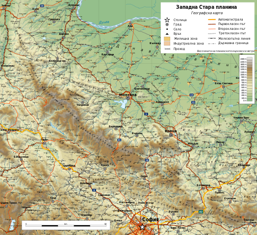
English: Geographic map of Western Stara Planina, Bulgaria in Bulgarian. Geographic limits of the map:
Български: Географска карта на Западна Стара планина и Западен Предбалкан. Карта на български. Граници на картата:
|
| Data | |
| Burimi |
Punë e juaja
|
| Autori | Ikonact |
| Leja (Ripërdor këtë skedë) |
Any use of this map is subject of the license(s) stated below with the condition that you credit (Wikimedia Commons user: Ikonact) as the author . A message with a reply address would also be greatly appreciated. |

|
Kjo skedë SVG përdor tekst i cili mund të përkthehet fare lehtë në gjuhën tënde përmes [toolforge:svgtranslate/File:Bulgaria_geographic_map_Western_Stara_Planina_bg.svglink këtij mjeti] në mënyrë automatike. Lexo më tepër. Gjithashtu ju mund ta shkarkoni këtë skedar dhe ta redaktoni manualisht përmes një tekst-editori. |
Licencim
| This work contains information from OpenStreetMap, which is made available under the Open Database License (ODbL).
The ODbL does not require any particular license for maps produced from ODbL data. Prior to 1 August 2020, map tiles produced by the OpenStreetMap Foundation were licensed under the CC-BY-SA-2.0 license. Maps produced by other people may be subject to other licences. |
- Je i lirë të:
- ta shpërndani – ta kopjoni, rishpërndani dhe përcillni punën
- t’i bëni “remix” – të përshtatni punën
- Sipas kushteve të mëposhtme:
- atribuim – Duhet t’i jepni meritat e duhura, të siguroni një lidhje për tek licenca dhe të tregoni nëse janë bërë ndryshime. Këtë mund ta bëni në ndonjë mënyrë të arsyeshme, por jo në ndonjë mënyrë që sugjeron se licencuesi ju del zot juve apo përdorimit tuaj.
- share alike – Nëse bëni një “remix”, e shndërroni, ose ndërtoni duke u bazuar te materiali, duhet t’i shpërndani kontributet tuaja sipas të njëjtës licencë ose një të tille të përputhshme me origjinalen.
Historiku skedës
Shtypni mbi një datë/kohë për ta parë skedën siç ishte atëherë.
| Data/Koha | Miniaturë | Përmasat | Përdoruesi | Koment | |
|---|---|---|---|---|---|
| e tanishme | 19 qershor 2019 13:47 | | 2.183 × 2.000 (18,89 MB) | Ikonact | Editing SVG source code using User:Rillke/SVGedit.js; upload handled by User:Rillke/MwJSBot.js |
| 17 qershor 2019 23:34 |  | 2.183 × 2.000 (18,89 MB) | Ikonact | few more names | |
| 17 qershor 2019 22:53 |  | 2.183 × 2.000 (19,01 MB) | Ikonact | pics added, font changes | |
| 16 qershor 2019 21:33 |  | 2.183 × 2.000 (19,06 MB) | Ikonact | == {{int:filedesc}} == {{Information |description={{en|1=Geographic map of Western Stara Planina, Bulgaria in Bulgarian. Geographic limits of the map:}} {{bg|1=Географска карта на Западна Стара планина и Западен Предбалкан. Карта на български. Граници на картата:}} *N: 43.95° N *S: 42.65° N *W: 22.25° E *E: 24.20° E Projection: Equidistant Cylindrical |date=2019-06-16 |source={{own}} *Sources of data:<br/> **Topography: NASA SRTM3 v3; **Rivers: Produced... |
Lidhje skedash
S’ka faqe që përdorin këtë kartelë.
Përdorimi global i skedës
Kjo skedë përdoret nga Wiki të tjera në vijim:
- Përdorimi në bg.wikipedia.org
- Стара планина
- Драгойца
- Софийска планина
- Три уши
- Чепън
- Пъстрина
- Врачанска планина
- Видлич
- Мургаш
- Милин камък
- Врачанско
- Монтанско
- Бабин нос
- География на Стара планина
- Берковска планина
- Ржана планина
- Етрополска планина
- Козница (Стара планина)
- Връшка чука
- Борованска могила
- Ведерник
- Венеца (рид в област Видин)
- Венеца (рид в област Враца)
- Веренишко бърдо
- Веслец (рид)
- Владимировски рид
- Гола глава
- Дреновица (рид)
- Зъбера
- Каменополско плато
- Лакавица (рид)
- Широка планина (планина)
- Било (планина)
- Голема планина
- Мала планина
- Понор (планина)
- Светиниколска планина
- Чипровска планина
- Язова планина
- Уикипедия:Картография на България/Планини
- Белоградчишко
- Звездец (връх)
- Берковско
- Ботевградско
- Софийско
- Годечко
- Туристическа спалня „Витиня“
- Шаблон:ПК България Западна Стара планина
- Përdorimi në hu.wikipedia.org
- Përdorimi në www.wikidata.org
Shikoni më shumë përdorim global të kësaj skede.