
Skeda:German Empire, Wilhelminian third version.svg

Size of this PNG preview of this SVG file: 800 × 551 pixel. Rezolucione të tjera: 320 × 220 pixel | 640 × 440 pixel | 1.024 × 705 pixel | 1.280 × 881 pixel | 2.560 × 1.762 pixel | 805 × 554 pixel.
Dokument origjinal (skedë SVG, fillimisht 805 × 554 pixel, madhësia e skedës: 641 KB)
| Kjo skedë është prej Wikimedia Commons dhe mund të përdoret nga projekte të tjera. Përshkrimi në këtë skedë në këtë faqe nuk është treguar më poshtë. | Shko tek faqja përshkruese në Commons |
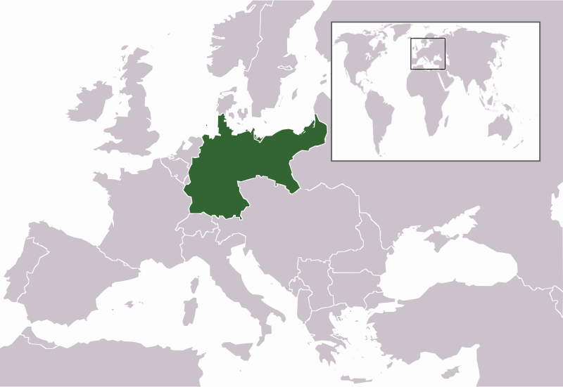
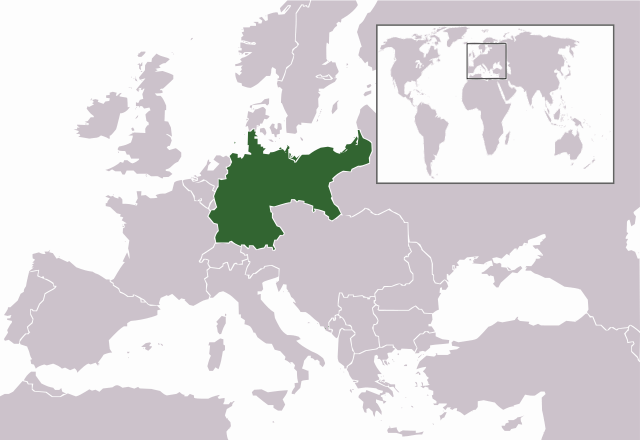
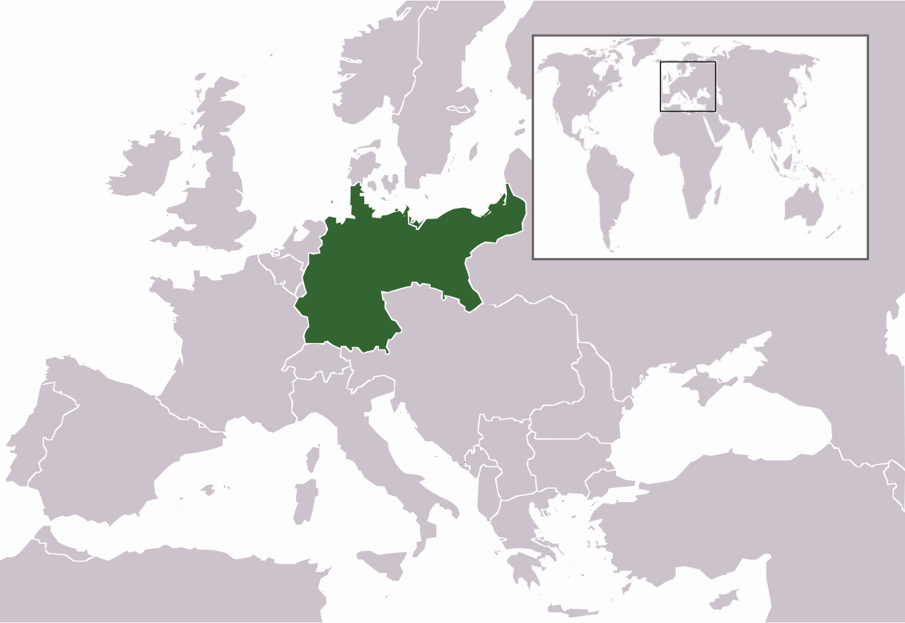
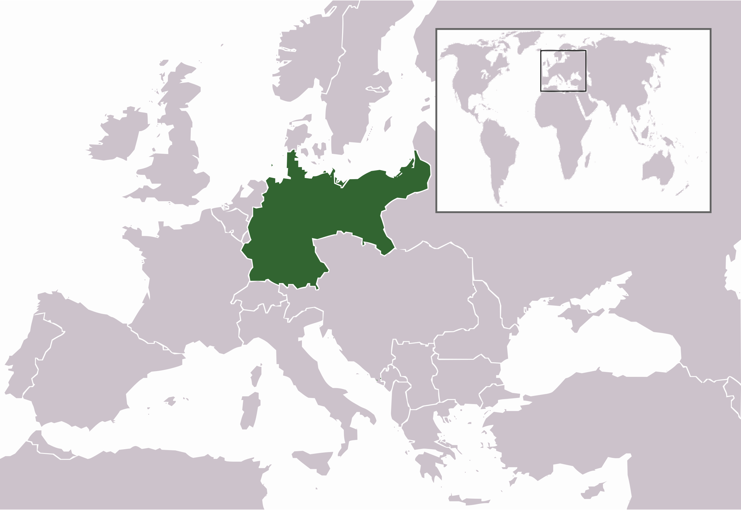
| Përshkrimi | Map of the German Empire (1871-1918) |
| Data | (UTC) |
| Burimi | |
| Autori |
|
| Versione tjera | File:German Empire, Wilhelminian third version.png.PNG |
Unë, krijuesi i kësaj pune, e publikoj këtu në bazë të licensës në vijim:
| Unë,krijuesi i kësaj pune, e lëshoj këtë punë në public domain. Kjo aplikohet në të gjithë botën. Në disa vende kjo mund të mos jetë e mundur ligjërisht; nëse është kështu: Unë i garantoj çdokujt të drejtën për ta përdorur këtë punë për çdo qëllim, pa asnjë kusht, përveç rasteve kur këto kushte janë të kërkuara nga ligji. |
Regjistri origjinal i ngarkimeve
This image is a derivative work of the following images:
- File:German_Empire,_Wilhelminian_third_version.png.PNG licensed with PD-self
- 2008-11-23T17:06:13Z MaggotMaster 805x553 (35442 Bytes) reverted to be more in line with every other map in wikipedia
- 2008-11-08T19:45:23Z Buonaparte69 805x553 (41061 Bytes) Reverted to version as of 19:42, 8 November 2008
- 2008-11-08T19:43:55Z Buonaparte69 805x553 (41004 Bytes) Blue is the imperial colour of FRANCE! BLACK is the imperial colour of GERMANY!
- 2008-11-08T19:42:15Z Buonaparte69 805x553 (41061 Bytes) Blue is the imperial colour of FRANCE! BLACK is the imperial colour of GERMANY!
- 2008-08-11T10:24:01Z The Kosovo Clan 805x553 (40972 Bytes) Blue is the imperial color of Germany.
- 2007-08-16T21:19:27Z R-41 805x553 (35442 Bytes) Forgot to save the last time I think, sorry, hopefully this time it will work
- 2007-08-16T21:17:26Z R-41 805x553 (35442 Bytes) Made colour of the highlighted country, the German Empire, the same as that of other highlighted countries on the grey world maps on wikipedia.
- 2006-12-22T22:09:02Z Electionworld 805x553 (40972 Bytes) {{ew|en|Lorpius Prime}} == Summary == Edited from previous version to "remove the annoying light grey of Austria-Hungary!" == Licensing == {{PD-self}}
Uploaded with derivativeFX
Historiku skedës
Shtypni mbi një datë/kohë për ta parë skedën siç ishte atëherë.
| Data/Koha | Miniaturë | Përmasat | Përdoruesi | Koment | |
|---|---|---|---|---|---|
| e tanishme | 1 maj 2009 21:25 | | 805 × 554 (641 KB) | Mnmazur | {{Information |Description=Map of the German Empire (1871-1918) |Source=*File:German_Empire,_Wilhelminian_third_version.png.PNG |Date=2009-05-01 20:24 (UTC) |Author=*File:German_Empire,_Wilhelminian_third_version.png.PNG: MaggotMaster *derivat |
Lidhje skedash
S’ka faqe që përdorin këtë kartelë.
Përdorimi global i skedës
Kjo skedë përdoret nga Wiki të tjera në vijim:
- Përdorimi në ar.wikipedia.org
- Përdorimi në as.wikipedia.org
- Përdorimi në azb.wikipedia.org
- Përdorimi në az.wikipedia.org
- Përdorimi në bh.wikipedia.org
- Përdorimi në bn.wikipedia.org
- Përdorimi në br.wikipedia.org
- Përdorimi në cdo.wikipedia.org
- Përdorimi në da.wikipedia.org
- Përdorimi në el.wikipedia.org
- Përdorimi në en.wikipedia.org
- Përdorimi në en.wikiversity.org
- Përdorimi në fo.wikipedia.org
- Përdorimi në gu.wikipedia.org
- Përdorimi në hak.wikipedia.org
- Përdorimi në hi.wikipedia.org
- Përdorimi në id.wikipedia.org
- Përdorimi në jv.wikipedia.org
- Përdorimi në km.wikipedia.org
Shikoni më shumë përdorim global të kësaj skede.