
Skeda:Judetul Vaslui 3D map.jpg

Madhësia e këtij shikimi: 800 × 576 pixel. Rezolucione të tjera: 320 × 230 pixel | 640 × 460 pixel | 1.062 × 764 pixel.
Dokument origjinal ((përmasa 1.062 × 764 px, madhësia skedës: 538 KB, lloji MIME: image/jpeg))
| Kjo skedë është prej Wikimedia Commons dhe mund të përdoret nga projekte të tjera. Përshkrimi në këtë skedë në këtë faqe nuk është treguar më poshtë. | Shko tek faqja përshkruese në Commons |
Përmbledhje
| Përshkrimi |
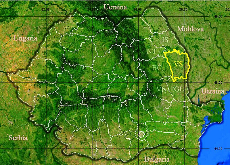
English: Location of Vaslui County in Romania. Deutsch: Lage der Kreis Vaslui in Rumänien. Română: Localizarea județului Vaslui în România. |
| Data | |
| Burimi |
|
| Autori | Asybaris01 |
Licencim
| This image is in the public domain because it is a screenshot from NASA’s globe software World Wind using a public domain layer, such as Blue Marble, MODIS, Landsat, SRTM, USGS or GLOBE.
|
 |
Historiku skedës
Shtypni mbi një datë/kohë për ta parë skedën siç ishte atëherë.
| Data/Koha | Miniaturë | Përmasat | Përdoruesi | Koment | |
|---|---|---|---|---|---|
| e tanishme | 24 shkurt 2020 19:19 | | 1.062 × 764 (538 KB) | Trecătorul răcit | Borders of countries |
| 27 nëntor 2011 20:50 |  | 1.062 × 764 (183 KB) | Asybaris01 | {{Information |Description ={{ro|1=Judetul Vaslui 3D map.}} |Source =Topographic data SRTM from NASA and World Imagery - NASA World Wind & 3Dem & Inkscape |Author =Asybaris01 |Date =nov 2011 |Permission |
Lidhje skedash
S’ka faqe që përdorin këtë kartelë.
Përdorimi global i skedës
Kjo skedë përdoret nga Wiki të tjera në vijim:
- Përdorimi në ace.wikipedia.org
- Përdorimi në ar.wikipedia.org
- Përdorimi në az.wikipedia.org
- Përdorimi në be.wikipedia.org
- Përdorimi në ca.wikipedia.org
- Përdorimi në el.wikipedia.org
- Përdorimi në eu.wikipedia.org
- Përdorimi në gl.wikipedia.org
- Përdorimi në ka.wikipedia.org
- Përdorimi në la.wikipedia.org
- Përdorimi në lmo.wikipedia.org
- Përdorimi në pt.wikipedia.org
- Përdorimi në ro.wikipedia.org
- Përdorimi në sr.wikipedia.org
- Përdorimi në www.wikidata.org