
Skeda:Kingdom of France (1789).svg

Size of this PNG preview of this SVG file: 450 × 456 pixel. Rezolucione të tjera: 237 × 240 pixel | 474 × 480 pixel | 758 × 768 pixel | 1.011 × 1.024 pixel | 2.021 × 2.048 pixel.
Dokument origjinal (skedë SVG, fillimisht 450 × 456 pixel, madhësia e skedës: 911 KB)
| Kjo skedë është prej Wikimedia Commons dhe mund të përdoret nga projekte të tjera. Përshkrimi në këtë skedë në këtë faqe nuk është treguar më poshtë. | Shko tek faqja përshkruese në Commons |
Përmbledhje


.svg)
.svg)
.svg)
.svg)
.svg)


.svg)
.svg)
.svg)


.png)
.png)


.svg)


.svg)

.svg)


.svg)
.svg)
.svg)
.svg)


.svg)
.png)


.svg)


.svg)
.svg)


.svg)


.svg)


.svg)
.svg)
.svg)
.svg)
.svg)
.svg)
.svg)
.svg)
_cropped.svg)
.svg)
.svg)
.svg)
.svg)
.svg)
.svg)
.svg)
.svg)
.svg)
.svg)
.svg)
.svg)
.svg)
.svg)
.svg)
.svg)
.svg)
.svg)
.svg)
.svg)
.svg)
.svg)
.svg)
.svg)
.svg)
.svg)
.svg)
.svg)
.svg)
.svg)
.svg)
.svg)
.svg)
.svg)
.svg)
.svg)
.svg)
.svg)
.svg)
.svg)
.svg)
.svg)
.svg)
.svg)
.svg)
Historiku skedës
Shtypni mbi një datë/kohë për ta parë skedën siç ishte atëherë.
| Data/Koha | Miniaturë | Përmasat | Përdoruesi | Koment | |
|---|---|---|---|---|---|
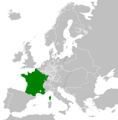
| e tanishme | 17 tetor 2021 10:12 | | 450 × 456 (911 KB) | Fenn-O-maniC | Fixed the Russo-Swedish border to match the Treaty of Åbo of 1743 |
| 29 dhjetor 2017 08:36 |  | 450 × 456 (914 KB) | TRAJAN 117 | Update | |
| 25 dhjetor 2017 03:55 |  | 450 × 456 (832 KB) | TRAJAN 117 | +++ | |
| 27 gusht 2013 04:14 |  | 450 × 456 (802 KB) | TRAJAN 117 | +++ | |
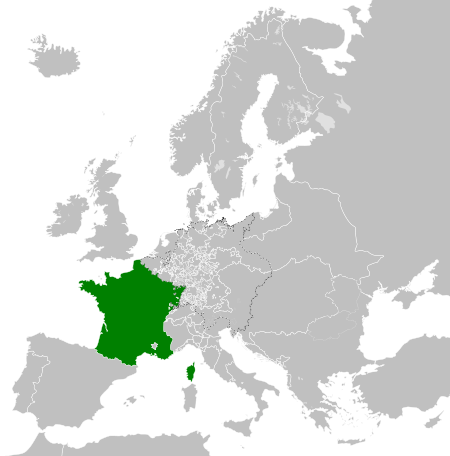
| 7 maj 2013 23:52 |  | 450 × 456 (839 KB) | TRAJAN 117 | {{Information |Description ={{en|1=The Kingdom of France in 1789.}} |Source ={{own}} {{AttribSVG|Europe 1789.svg|Alphathon}} |Author =TRAJAN 117 {{created with Inkscape}} |Date =2013-05-07 |Permission ... |
Lidhje skedash
Këto faqe lidhen tek kjo skedë:
Përdorimi global i skedës
Kjo skedë përdoret nga Wiki të tjera në vijim:
- Përdorimi në ar.wikipedia.org
- Përdorimi në arz.wikipedia.org
- Përdorimi në ast.wikipedia.org
- Përdorimi në az.wikipedia.org
- Përdorimi në be.wikipedia.org
- Përdorimi në bg.wikipedia.org
- Përdorimi në cs.wikipedia.org
- Përdorimi në da.wikipedia.org
- Përdorimi në de.wikipedia.org
- Përdorimi në el.wikipedia.org
- Përdorimi në en.wikipedia.org
- Përdorimi në es.wikipedia.org
- Përdorimi në fa.wikipedia.org
- Përdorimi në fi.wikipedia.org
- Përdorimi në fr.wikipedia.org
- Përdorimi në ga.wikipedia.org
- Përdorimi në gl.wikipedia.org
- Përdorimi në he.wikipedia.org
- Përdorimi në hr.wikipedia.org
- Përdorimi në hu.wikipedia.org
- Përdorimi në id.wikipedia.org
- Përdorimi në incubator.wikimedia.org
- Përdorimi në is.wikipedia.org
- Përdorimi në it.wikipedia.org
- Përdorimi në ja.wikipedia.org
- Përdorimi në ka.wikipedia.org
- Përdorimi në ko.wikipedia.org
- Përdorimi në lfn.wikipedia.org
- Përdorimi në lmo.wikipedia.org
- Përdorimi në lt.wikipedia.org
- Përdorimi në lv.wikipedia.org
- Përdorimi në ms.wikipedia.org
- Përdorimi në no.wikipedia.org
Shikoni më shumë përdorim global të kësaj skede.
.svg)
.svg)