
Skeda:Kingdom of Sicily 1190.svg

Size of this PNG preview of this SVG file: 550 × 375 pixel. Rezolucione të tjera: 320 × 218 pixel | 640 × 436 pixel | 1.024 × 698 pixel | 1.280 × 873 pixel | 2.560 × 1.745 pixel.
Dokument origjinal (skedë SVG, fillimisht 550 × 375 pixel, madhësia e skedës: 998 KB)
| Kjo skedë është prej Wikimedia Commons dhe mund të përdoret nga projekte të tjera. Përshkrimi në këtë skedë në këtë faqe nuk është treguar më poshtë. | Shko tek faqja përshkruese në Commons |
Përmbledhje
This W3C-unspecified vector image was created with Inkscape .


.svg)
.svg)
.svg)
.svg)
.svg)


.svg)
.svg)
.svg)


.png)
.png)


.svg)


.svg)

.svg)


.svg)
.svg)
.svg)
.svg)


.svg)
.png)


.svg)


.svg)
.svg)


.svg)


.svg)


.svg)
.svg)
.svg)
.svg)
.svg)
.svg)
.svg)
_cropped.svg)
.svg)
.svg)
.svg)
.svg)
.svg)
.svg)
.svg)
.svg)
.svg)
.svg)
.svg)
.svg)
.svg)
.svg)
.svg)
.svg)
.svg)
.svg)
.svg)
.svg)
.svg)
.svg)
.svg)
.svg)
.svg)
.svg)
.svg)
.svg)
.svg)
.svg)
.svg)
.svg)
.svg)
.svg)
.svg)
.svg)
.svg)
.svg)
.svg)
.svg)
.svg)
.svg)
.svg)
.svg)
.svg)
Licencim
This file is licensed under the Creative Commons Attribution-Share Alike 4.0 International license.
- Je i lirë të:
- ta shpërndani – ta kopjoni, rishpërndani dhe përcillni punën
- t’i bëni “remix” – të përshtatni punën
- Sipas kushteve të mëposhtme:
- atribuim – Duhet t’i jepni meritat e duhura, të siguroni një lidhje për tek licenca dhe të tregoni nëse janë bërë ndryshime. Këtë mund ta bëni në ndonjë mënyrë të arsyeshme, por jo në ndonjë mënyrë që sugjeron se licencuesi ju del zot juve apo përdorimit tuaj.
- share alike – Nëse bëni një “remix”, e shndërroni, ose ndërtoni duke u bazuar te materiali, duhet t’i shpërndani kontributet tuaja sipas të njëjtës licencë ose një të tille të përputhshme me origjinalen.
Historiku skedës
Shtypni mbi një datë/kohë për ta parë skedën siç ishte atëherë.
| Data/Koha | Miniaturë | Përmasat | Përdoruesi | Koment | |
|---|---|---|---|---|---|
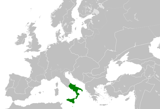
| e tanishme | 29 maj 2016 17:58 | | 550 × 375 (998 KB) | Alphathon | == {{int:filedesc}} == {{Inkscape}} {{Information |Description={{en|A map of the Norman en:Kingdom of Sicily within Europe circa 1190 CE. Note that the borders of the Cumans, Kipchaks, Kievan Rus', Kama Bulgarians and Viatka do not extend r... |
Lidhje skedash
Këto faqe lidhen tek kjo skedë:
Përdorimi global i skedës
Kjo skedë përdoret nga Wiki të tjera në vijim:
- Përdorimi në arz.wikipedia.org
- Përdorimi në ast.wikipedia.org
- Përdorimi në ca.wikipedia.org
- Përdorimi në cs.wikipedia.org
- Përdorimi në en.wikipedia.org
- Përdorimi në eo.wikipedia.org
- Përdorimi në es.wikipedia.org
- Përdorimi në gl.wikipedia.org
- Përdorimi në he.wikipedia.org
- Përdorimi në it.wikipedia.org
- Përdorimi në ja.wikipedia.org
- Përdorimi në ko.wikipedia.org
- Përdorimi në la.wikipedia.org
- Përdorimi në lv.wikipedia.org
- Përdorimi në mk.wikipedia.org
- Përdorimi në pl.wikipedia.org
- Përdorimi në ro.wikipedia.org
- Përdorimi në sc.wikipedia.org
- Përdorimi në simple.wikipedia.org
- Përdorimi në th.wikipedia.org
- Përdorimi në uk.wikipedia.org
- Përdorimi në vi.wikipedia.org
- Përdorimi në www.wikidata.org