
Skeda:Kliuchevskoi volcanic group topo.jpg
Madhësia e këtij shikimi: 550 × 600 pixel. Rezolucione të tjera: 220 × 240 pixel | 440 × 480 pixel | 704 × 768 pixel | 939 × 1.024 pixel | 1.874 × 2.044 pixel.
Dokument origjinal ((përmasa 1.874 × 2.044 px, madhësia skedës: 522 KB, lloji MIME: image/jpeg))
| Kjo skedë është prej Wikimedia Commons dhe mund të përdoret nga projekte të tjera. Përshkrimi në këtë skedë në këtë faqe nuk është treguar më poshtë. | Shko tek faqja përshkruese në Commons |
Përmbledhje
| Përshkrimi |
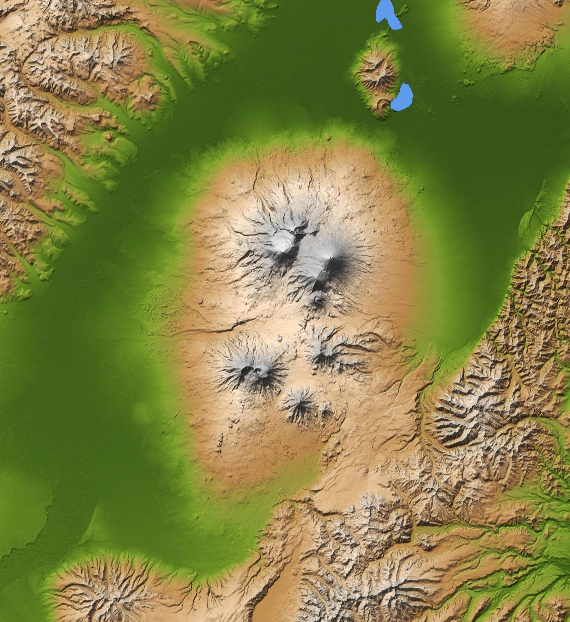
Français : Carte topographique du groupe volcanique du Klioutchevskoï, péninsule du Kamtchatka, Russie English: Topographic map of Kliuchevskoi volcanic group, Kamchatka peninsula, Russia |
| Data | |
| Burimi | Cropped version of File:Kamchatka peninsula topo.jpg |
| Autori | NASA/JPL/NIMA |
| Versione tjera | File:Kamchatka peninsula topo.jpg |
Licencim
This image uses high-resolution digital topography data from NASA's Shuttle Radar Topography Mission (SRTM) at JPL-Caltech [1]. It is in the public domain in the United States.
|
 | |
| Annotations | This image is annotated: View the annotations at Commons |
Historiku skedës
Shtypni mbi një datë/kohë për ta parë skedën siç ishte atëherë.
| Data/Koha | Miniaturë | Përmasat | Përdoruesi | Koment | |
|---|---|---|---|---|---|
| e tanishme | 2 shkurt 2012 11:51 | | 1.874 × 2.044 (522 KB) | Rémih |
Lidhje skedash
S’ka faqe që përdorin këtë kartelë.
Përdorimi global i skedës
Kjo skedë përdoret nga Wiki të tjera në vijim:
- Përdorimi në fr.wikipedia.org
- Përdorimi në he.wikipedia.org
- Përdorimi në hu.wikipedia.org