
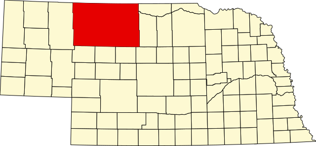
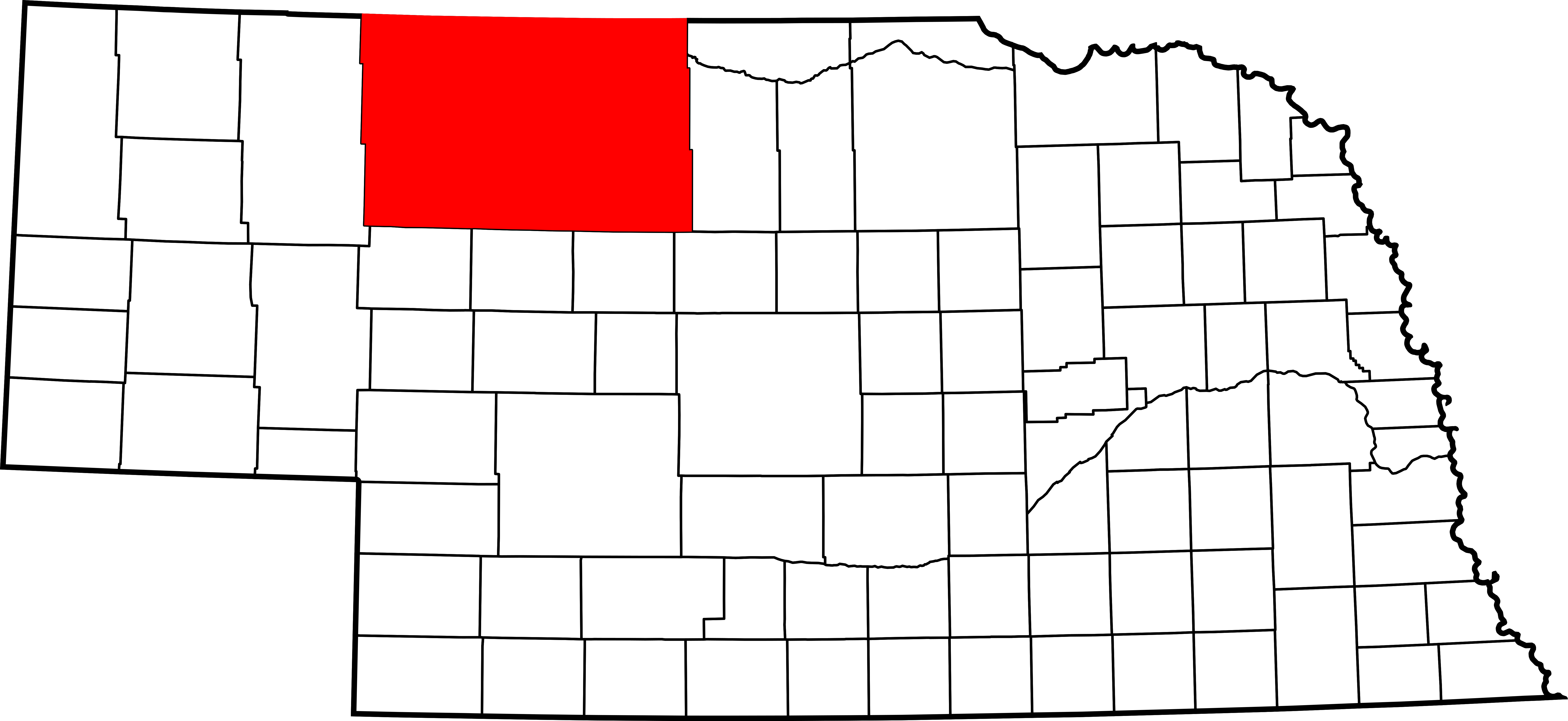
Skeda:Map of Nebraska highlighting Cherry County.svg

Size of this PNG preview of this SVG file: 800 × 368 pixel. Rezolucione të tjera: 320 × 147 pixel | 640 × 294 pixel | 1.024 × 471 pixel | 1.280 × 589 pixel | 2.560 × 1.178 pixel | 7.414 × 3.411 pixel.
Dokument origjinal (skedë SVG, fillimisht 7.414 × 3.411 pixel, madhësia e skedës: 34 KB)
| Kjo skedë është prej Wikimedia Commons dhe mund të përdoret nga projekte të tjera. Përshkrimi në këtë skedë në këtë faqe nuk është treguar më poshtë. | Shko tek faqja përshkruese në Commons |
Përmbledhje
| Përshkrimi |
English: This is a locator map showing Cherry County in Nebraska. For more information, see Commons:United States county locator maps. |
| Data | |
| Burimi |
Punë e juaja: English: The maps use data from nationalatlas.gov, specifically countyp020.tar.gz on the Raw Data Download page. The maps also use state outline data from statesp020.tar.gz. The Florida maps use hydrogm020.tar.gz to display Lake Okeechobee. |
| Autori | David Benbennick |
Licencim
| Unë,krijuesi i kësaj pune, e lëshoj këtë punë në public domain. Kjo aplikohet në të gjithë botën. Në disa vende kjo mund të mos jetë e mundur ligjërisht; nëse është kështu: Unë i garantoj çdokujt të drejtën për ta përdorur këtë punë për çdo qëllim, pa asnjë kusht, përveç rasteve kur këto kushte janë të kërkuara nga ligji. |
Historiku skedës
Shtypni mbi një datë/kohë për ta parë skedën siç ishte atëherë.
| Data/Koha | Miniaturë | Përmasat | Përdoruesi | Koment | |
|---|---|---|---|---|---|
| e tanishme | 12 shkurt 2006 15:32 | | 7.414 × 3.411 (34 KB) | David Benbennick | {{subst:User:Dbenbenn/clm|county=Cherry County|state=Nebraska|type=county}} |
Lidhje skedash
S’ka faqe që përdorin këtë kartelë.
Përdorimi global i skedës
Kjo skedë përdoret nga Wiki të tjera në vijim:
- Përdorimi në ar.wikipedia.org
- Përdorimi në bg.wikipedia.org
- Përdorimi në bpy.wikipedia.org
- Përdorimi në ca.wikipedia.org
- Përdorimi në cdo.wikipedia.org
- Përdorimi në ceb.wikipedia.org
- Përdorimi në ce.wikipedia.org
- Përdorimi në cy.wikipedia.org
- Përdorimi në de.wikipedia.org
- Përdorimi në en.wikipedia.org
- List of counties in Nebraska
- Cherry County, Nebraska
- Cody, Nebraska
- Crookston, Nebraska
- Kilgore, Nebraska
- Merriman, Nebraska
- Nenzel, Nebraska
- Valentine, Nebraska
- Wood Lake, Nebraska
- Template:Cherry County, Nebraska
- DeWitty, Nebraska
- Spade Ranch (Nebraska)
- Elsmere, Nebraska
- Sparks, Nebraska
- User:Nyttend/County templates/NE
- National Register of Historic Places listings in Cherry County, Nebraska
- Category:Populated places in Cherry County, Nebraska
- Adamson Bridge
- Bell Bridge
- Berry State Aid Bridge
- Borman Bridge
- Dry Valley Church and Cemetery
- F.M. Walcott House
- Brewer Bridge
- Twin Bridge (Brownlee, Nebraska)
- Cherry County Courthouse
- Bryan Bridge
- Valentine Public School
- United States Post Office-Valentine
Shikoni më shumë përdorim global të kësaj skede.