
Skeda:Ngorongoro topo.jpg
Dokument origjinal ((përmasa 1.061 × 1.061 px, madhësia skedës: 471 KB, lloji MIME: image/jpeg))
| Kjo skedë është prej Wikimedia Commons dhe mund të përdoret nga projekte të tjera. Përshkrimi në këtë skedë në këtë faqe nuk është treguar më poshtë. | Shko tek faqja përshkruese në Commons |
Përmbledhje
| Përshkrimi |
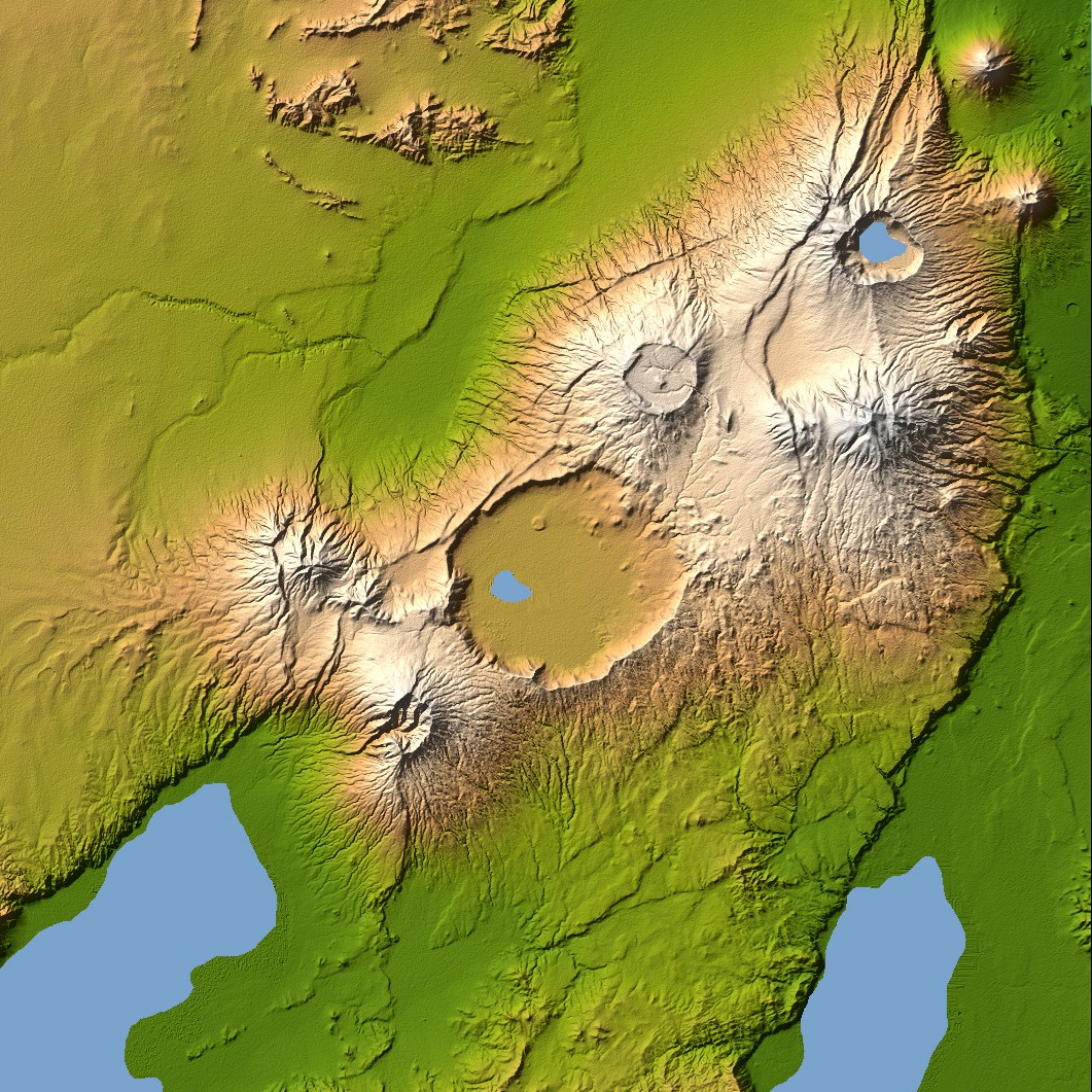
Ngorongoro’s caldera is 22.5 kilometers (14 miles) across at its widest point and is 610 meters (2,000 feet) deep. Its floor is very level, holding a lake fed by streams running down the caldera wall. It is part of the Ngorongoro Conservation Area and is home to over 75,000 animals. The lakes south of the crater are Lake Eyasi and Lake Manyara, also part of the conservation area. Orientation: North toward the top, Mercator projection Image Data: shaded and colored SRTM elevation model. The shade image was derived by computing topographic slope in the northwest-southeast direction, so that northwest slopes appear bright and southeast slopes appear dark. Color coding is directly related to topographic height, with green at the lower elevations, rising through yellow and tan, to white at the highest elevations. Date Acquired: February 2000 |
| Data | |
| Burimi | NASA Earth Observatory, Topography of Olduvai Gorge, East Africa (Outcut) |
| Autori | NASA |
Licencim
| This file is in the public domain in the United States because it was solely created by NASA. NASA copyright policy states that "NASA material is not protected by copyright unless noted". (See Template:PD-USGov, NASA copyright policy page or JPL Image Use Policy.) | ||
 |
Warnings:
|
Historiku skedës
Shtypni mbi një datë/kohë për ta parë skedën siç ishte atëherë.
| Data/Koha | Miniaturë | Përmasat | Përdoruesi | Koment | |
|---|---|---|---|---|---|
| e tanishme | 27 dhjetor 2005 20:56 | | 1.061 × 1.061 (471 KB) | Lotse | ==Description== Ngorongoro’s caldera is 22.5 kilometers (14 miles) across at its widest point and is 610 meters (2,000 feet) deep. Its floor is very level, holding a lake fed by streams running down the caldera wall. It is part of the Ngorongoro Conserv |
Lidhje skedash
S’ka faqe që përdorin këtë kartelë.
Përdorimi global i skedës
Kjo skedë përdoret nga Wiki të tjera në vijim:
- Përdorimi në ast.wikipedia.org
- Përdorimi në avk.wikipedia.org
- Përdorimi në be.wikipedia.org
- Përdorimi në ca.wikipedia.org
- Përdorimi në cs.wikipedia.org
- Përdorimi në da.wikipedia.org
- Përdorimi në de.wikipedia.org
- Përdorimi në en.wikipedia.org
- Përdorimi në eo.wikipedia.org
- Përdorimi në es.wikipedia.org
- Përdorimi në et.wikipedia.org
- Përdorimi në fi.wikipedia.org
- Përdorimi në fr.wikipedia.org
- Përdorimi në gl.wikipedia.org
- Përdorimi në hy.wikipedia.org
- Përdorimi në it.wikipedia.org
- Përdorimi në nl.wikipedia.org
- Përdorimi në ro.wikipedia.org
- Përdorimi në ru.wikipedia.org
- Përdorimi në sv.wikipedia.org
- Përdorimi në sw.wikipedia.org
- Përdorimi në uk.wikipedia.org
- Përdorimi në www.wikidata.org
- Përdorimi në zh.wikipedia.org