
Skeda:SDUK - Turkey II. Containing the Northern Part of Greece.jpg

Madhësia e këtij shikimi: 800 × 544 pixel. Rezolucione të tjera: 320 × 217 pixel | 640 × 435 pixel | 1.024 × 696 pixel | 1.280 × 870 pixel | 2.560 × 1.739 pixel | 5.764 × 3.916 pixel.
Dokument origjinal ((përmasa 5.764 × 3.916 px, madhësia skedës: 3,96 MB, lloji MIME: image/jpeg))
| Kjo skedë është prej Wikimedia Commons dhe mund të përdoret nga projekte të tjera. Përshkrimi në këtë skedë në këtë faqe nuk është treguar më poshtë. | Shko tek faqja përshkruese në Commons |
Përmbledhje
| Përshkrimi |
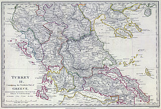
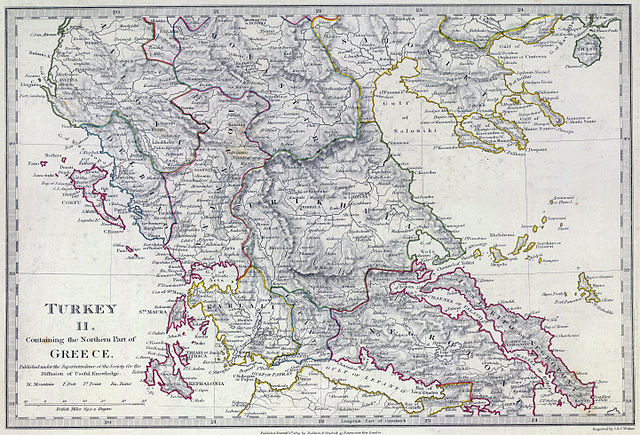
English: The southern provinces of European Turkey (Ottoman Empire) in 1829, including the northern portions of independent Greece (not differentiated in this map, which shows the pre-Greek War of Independence administrative boundaries). Published under the superintendence of the Society for the Diffusion of Useful Knowledge. |
| Data | |
| Burimi | David Rumsey Historical Map Collection |
| Autori | Engraved by J. & C. Walker. Published September 1st. 1829 by Baldwin & Cradock, 47 Paternoster Row, London. (London: Chapman & Hall, 1844) |
Licencim
|
This work is in the public domain in its country of origin and other countries and areas where the copyright term is the author's life plus 100 years or fewer. | |
| Kjo skedë është identifikuar si e lirë e kufizimeve të panjohura në ligjin e të drejtave të autorit, duke përfshirë të gjitha të drejtat e lidhura dhe fqinje. | |
Historiku skedës
Shtypni mbi një datë/kohë për ta parë skedën siç ishte atëherë.
| Data/Koha | Miniaturë | Përmasat | Përdoruesi | Koment | |
|---|---|---|---|---|---|
| e tanishme | 12 shkurt 2013 18:07 | | 5.764 × 3.916 (3,96 MB) | Cplakidas | User created page with UploadWizard |
Lidhje skedash
Këto faqe lidhen tek kjo skedë:
Përdorimi global i skedës
Kjo skedë përdoret nga Wiki të tjera në vijim:
- Përdorimi në bg.wikipedia.org
- Përdorimi në ca.wikipedia.org
- Përdorimi në el.wikipedia.org
- Përdorimi në en.wikipedia.org
- Përdorimi në fr.wikipedia.org
- Përdorimi në it.wikipedia.org
- Përdorimi në mk.wikipedia.org
- Përdorimi në ru.wikipedia.org
- Përdorimi në tr.wikipedia.org