
Skeda:Saudia Arabia topographic map.jpg
Madhësia e këtij shikimi: 790 × 599 pixel. Rezolucione të tjera: 316 × 240 pixel | 633 × 480 pixel | 933 × 708 pixel.
Dokument origjinal ((përmasa 933 × 708 px, madhësia skedës: 280 KB, lloji MIME: image/jpeg))
| Kjo skedë është prej Wikimedia Commons dhe mund të përdoret nga projekte të tjera. Përshkrimi në këtë skedë në këtë faqe nuk është treguar më poshtë. | Shko tek faqja përshkruese në Commons |
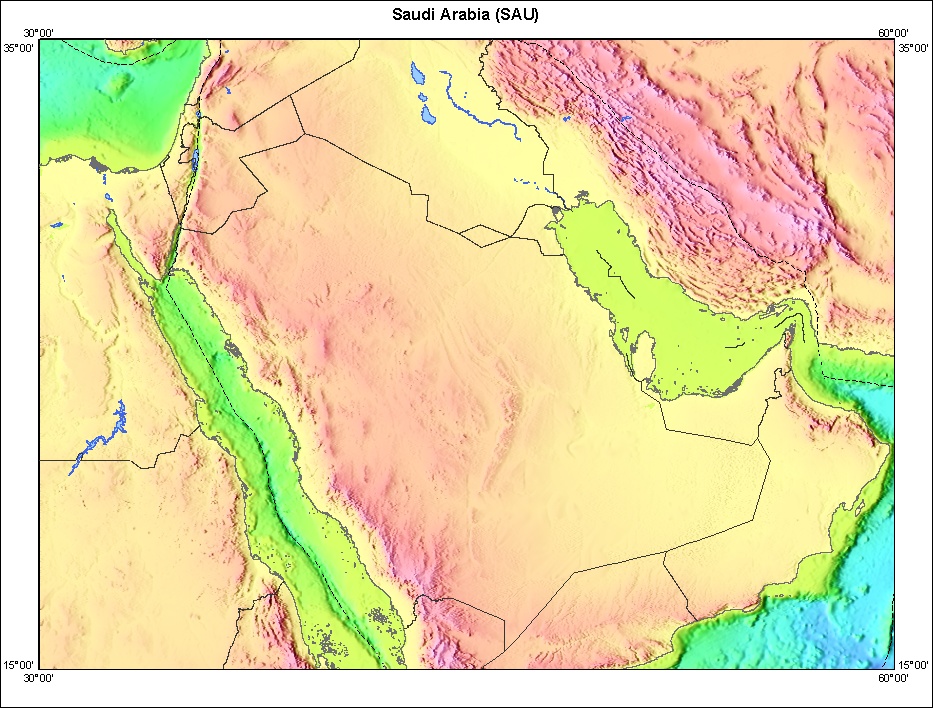
Topography of Saudia Arabia and surrounding countries.
http://walrus.wr.usgs.gov/infobank/gazette/html/regions/sau.html
This image is in the public domain in the United States because it only contains materials that originally came from the United States Geological Survey, an agency of the United States Department of the Interior. For more information, see the official USGS copyright policy.
|


Historiku skedës
Shtypni mbi një datë/kohë për ta parë skedën siç ishte atëherë.
| Data/Koha | Miniaturë | Përmasat | Përdoruesi | Koment | |
|---|---|---|---|---|---|
| e tanishme | 27 tetor 2005 02:10 | | 933 × 708 (280 KB) | Brian0918 | Topography of Saudia Arabia and surrounding countries. http://walrus.wr.usgs.gov/infobank/gazette/html/regions/sau.html {{PD-USGov-Interior-USGS}} Category:Maps of Saudi Arabia |
Lidhje skedash
S’ka faqe që përdorin këtë kartelë.
Përdorimi global i skedës
Kjo skedë përdoret nga Wiki të tjera në vijim:
- Përdorimi në bn.wikipedia.org
- Përdorimi në en.wikipedia.org
- Përdorimi në es.wikipedia.org
- Përdorimi në fr.wikipedia.org
- Përdorimi në gl.wikipedia.org
- Përdorimi në mk.wikipedia.org
- Përdorimi në nn.wikipedia.org
- Përdorimi në ru.wikipedia.org