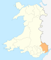
Skeda:Wales Monmouthshire locator map.svg
Appearance

Size of this PNG preview of this SVG file: 502 × 600 pixel. Rezolucione të tjera: 201 × 240 pixel | 402 × 480 pixel | 643 × 768 pixel | 857 × 1.024 pixel | 1.714 × 2.048 pixel | 1.047 × 1.251 pixel.
Dokument origjinal (skedë SVG, fillimisht 1.047 × 1.251 pixel, madhësia e skedës: 149 KB)
Historiku skedës
Shtypni mbi një datë/kohë për ta parë skedën siç ishte atëherë.
| Data/Koha | Miniaturë | Përmasat | Përdoruesi | Koment | |
|---|---|---|---|---|---|
| e tanishme | 4 maj 2010 19:54 |  | 1.047 × 1.251 (149 KB) | NordNordWest | {{int:filedesc}} {{Information |Description= {{de|Lagekarte von Monmouthshire in Wales}} {{en|Locator map of Monmouthshire in Wales}} |Source={{Own}} |Date=2010-05-04 |Author={{U|NordNordWest}} |Permission={{self|cc-by-sa-3.0}} |other_versions= }} {{Kart |
Lidhje skedash
Këto faqe lidhen tek kjo skedë:
Përdorimi global i skedës
Kjo skedë përdoret nga Wiki të tjera në vijim:
- Përdorimi në cs.wikipedia.org
- Përdorimi në en.wikipedia.org
- Abergavenny
- Monmouth
- Usk
- Chepstow
- Monmouthshire
- Caldicot
- Caerwent
- Llanelly
- Rogiet
- List of places in Monmouthshire
- Little Mill, Monmouthshire
- Template:Monmouthshire-geo-stub
- Llanbadoc
- Wye Valley
- River Trothy
- Llanarth, Monmouthshire
- Grosmont, Monmouthshire
- Graig Syfyrddin
- Monnow Valley Walk
- Tregare
- Blaina
- Llanddewi Rhydderch
- Ashvale, Blaenau Gwent
- Govilon
- Llantilio Pertholey
- Llanvihangel Gobion
- Llangattock Lingoed
- Llanvihangel-Ystern-Llewern
- Cross Ash
- Bryngwyn
- Cwmcarvan
- Mitchel Troy
- Newbridge-on-Usk
- Mardy, Monmouthshire
- Wolvesnewton
- Llanover
- Llancayo
- Llandenny
- Llanvetherine
- Mamhilad
- Oldcastle, Monmouthshire
- Llantrisant, Monmouthshire
- Llanwenarth
- St Arvans
- Catbrook
- Glascoed
- Llansoy
- St Maughans
- Monkswood, Monmouthshire
Shikoni më shumë përdorim global të kësaj skede.

