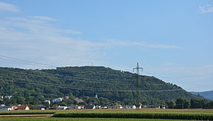
Bisamberg
Appearance
komunë në Austri
instancë e
market municipality
municipality of Austria
e vendosur në entitetin territorial administrativ të
Korneuburg District
e vendosur në zonën kohore
UTC+1
e vlefshme në periudhën: koha standarde
UTC+02:00
e vlefshme në periudhën: Llogaritja verore e kohës
koordinatat
anëtar i
popullsia
lartësia mbidetare
192 metër
sipërfaqja
kodi postar
2102
adresë elektronike
webfaqja zyrtare
lista e monumenteve
Cultural heritage monuments in Bisamberg
associated cadastral district
Bisamberg
Klein-Engersdorf
prefiksi telefonik lokal
02262
kodi i targës
KO
formë tjetër
Q866016
kategoria në Commons
Bisamberg, Lower Austria
kategoria kryesore
Category:Bisamberg, Lower Austria
category of associated people
Category:People from Bisamberg
Reference
- ^ Freebase Data Dumps, 28 tetor 2013
- ^ n2004153868, 15 prill 2024, Library of Congress Authorities
- ^ GeoNames
- ^ MusicBrainz
- ^ archINFORM, https://www.archinform.net/service/wd_aiort.php, 5 gusht 2018
- ^ Datoteka e Autoritetit Virtual Ndërkombëtar, 4 gusht 2015
- ^ National Library of Israel Names and Subjects Authority File
- ^ archINFORM, 6 gusht 2018, 10082
- ^ http://www.klimabuendnis.org/nc/kommunen/das-netzwerk.html
- ^ 9 mars 2019, https://www.statistik.at/web_de/klassifikationen/regionale_gliederungen/gemeinden/index.html, Statistics Austria, Einwohnerzahl 1.1.2018 nach Gemeinden mit Status, Gebietsstand 1.1.2018
- ^ 10 mars 2019, http://www.statistik.at/web_de/klassifikationen/regionale_gliederungen/dauersiedlungsraum/index.html, Statistics Austria, Dauersiedlungsraum der Gemeinden Politischen Bezirke und Bundesländer - Gebietsstand 1.1.2018
- ^ https://raw.githubusercontent.com/bresu/oe_gemeinden/a41434c7941c8902852ad6849e48a78cf475a80c/gemeinden_CSV.csv


