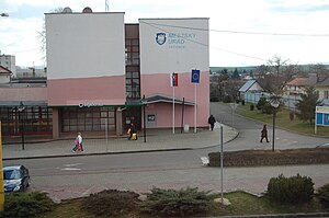
Sečovce
Appearance
town in Slovakia
fillimi
1245
emri zyrtar
Sečovce
emërtimi në gjuhën amë
Sečovce
shteti
Sllovakia
koha e fillimit: 1 janar 1993
e vendosur në entitetin territorial administrativ të
Trebišov District
e vendosur në zonën kohore
UTC+1
e vlefshme në periudhën: koha standarde
UTC+02:00
e vlefshme në periudhën: Llogaritja verore e kohës
koordinatat
popullsia
lartësia mbidetare
136 metër
sipërfaqja
32,658 kilometër katror
kodi postar
07801
adresë elektronike
webfaqja zyrtare
koha e dokumentit më të hershëm të shkruar
1245
prefiksi telefonik lokal
056
kodi i targës
TV
Galeria në Commons
Sečovce
kategoria në Commons
Sečovce
kategoria kryesore
Category:Sečovce
category of associated people
Category:People from Sečovce
kategoria e njerëzve të lindur këtu
Q44822403
category for maps or plans
Category:Maps of Sečovce
Reference
- ^ Freebase Data Dumps, 28 tetor 2013
- ^ Datoteka e Autoritetit Virtual Ndërkombëtar, 6 mars 2019
- ^ Decree of the Statistical Office of the Slovak Republic no. 438/2004 Coll., which issues the classification of statistical territorial units, 8 dhjetor 2023
- ^ GeoNames
- ^ archINFORM, https://www.archinform.net/service/wd_aiort.php, 5 gusht 2018
- ^ Czech National Authority Database, 20 dhjetor 2018
- ^ Datoteka e Autoritetit Virtual Ndërkombëtar, 5 gusht 2015
- ^ GND
- ^ National Library of Israel Names and Subjects Authority File
- ^ The 2021 Population and Housing Census


