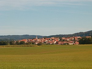
Bolandoz
Appearance
komunë në departamentin Doubs, Francë
instancë e
emri zyrtar
Bolandoz[4]
shteti
e vendosur në zonën kohore
UTC+1
e vlefshme në periudhën: koha standarde
UTC+02:00
e vlefshme në periudhën: Llogaritja verore e kohës
associated electoral district
koordinatat
office held by head of government
Mayor of Bolandoz
sipërfaqja
12,21 kilometër katror[6]
kodi postar
25330[11]
numri i telefonit
+33-3-81-86-53-32[12]
adresë elektronike
kategoria në Commons
Bolandoz
kategoria kryesore
Category:Bolandoz
category for maps or plans
Category:Maps of Bolandoz
Reference
- ^ Freebase Data Dumps, 28 tetor 2013
- ^ GeoNames
- ^ BnF authorities, 26 gusht 2015
- ^ Code officiel géographique, https://www.insee.fr/fr/information/3363419, 6 janar 2019
- ^ Code officiel géographique, 22 shtator 2017, https://www.insee.fr/fr/information/2560698
- ^ a b répertoire géographique des communes, 26 tetor 2015
- ^ Populations de référence 2022
- ^ a b The National Institute of Statistics and Economic Studies
- ^ a b répertoire géographique des communes, https://wxs-telechargement.ign.fr/83edtfdyqte031y0ra49d2e3/telechargement/inspire/RGC-2015-01$RGC2015/file/RGC2015.7z, RGC_2015.txt, 2015, http://web.archive.org/web/20160804005551if_/https://wxs-telechargement.ign.fr/83edtfdyqte031y0ra49d2e3/telechargement/inspire/RGC-2015-01$RGC2015/file/RGC2015.7z
- ^ Déservillers
- ^ dataset of postal codes in France, 1 tetor 2018
- ^ a b Annuaire de service-public.fr, 24 shtator 2023


