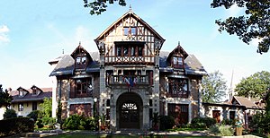
Sarcelles
Appearance
komunë në departamentin Val-d'Oise, Francë
instancë e
emri zyrtar
Sarcelles[13]
shteti
e vendosur në entitetin territorial administrativ të
Seine-et-Oise
koha e fillimit: 4 mars 1790
koha e përfundimit: 1 janar 1968
Val-d'Oise
koha e fillimit: 1 janar 1968
Communauté d’agglomération Roissy Pays de France
e vendosur në zonën kohore
UTC+1
e vlefshme në periudhën: koha standarde
UTC+02:00
e vlefshme në periudhën: Llogaritja verore e kohës
located in statistical territorial entity
Q108921672
Paris unité urbaine
associated electoral district
koordinatat
office held by head of government
Mayor of Sarcelles
kryetar i qeverisjes
François Pupponi
koha e fillimit: 3 qershor 1997
anëtar i
Concours des villes et villages fleuris[18]
lartësia mbidetare
75 metër
kufizohet me
Écouen
Villiers-le-Bel
Stains
Pierrefitte-sur-Seine
Garges-lès-Gonesse
Groslay
Montmagny
Saint-Brice-sous-Forêt
sipërfaqja
8,45 kilometër katror[17]
kodi postar
95200[23]
numri i telefonit
+33-1-34-38-21-40[24]
adresë elektronike
webfaqja zyrtare
contact page URL
kategoria në Commons
Sarcelles
kategoria kryesore
Category:Sarcelles
category of associated people
Category:People from Sarcelles
kategoria e njerëzve të lindur këtu
Category:Births in Sarcelles
category for people who died here
Category:Deaths in Sarcelles
category for people buried here
Q32466276
category for maps
Category:Maps of Sarcelles
Reference
- ^ n90712215, 19 mars 2024, Library of Congress Authorities
- ^ MusicBrainz
- ^ BnF authorities, 26 gusht 2015
- ^ Code officiel géographique, https://www.insee.fr/fr/information/4316069, 15 prill 2020
- ^ a b c Datoteka e Autoritetit Virtual Ndërkombëtar, 1 qershor 2024, 135002545
- ^ https://www.facebook.com/sarcellesmaville/, Ville de Sarcelles | Facebook, 18 qershor 2022
- ^ a b c Annuaire de service-public.fr, 21 shtator 2023
- ^ Freebase Data Dumps, 28 tetor 2013
- ^ GeoNames
- ^ archINFORM, https://www.archinform.net/service/wd_aiort.php, 5 gusht 2018
- ^ Quora
- ^ Datoteka e Autoritetit Virtual Ndërkombëtar, 2 gusht 2015
- ^ Code officiel géographique, https://www.insee.fr/fr/information/3363419, 6 janar 2019
- ^ Qarku Sarcelles
- ^ Kantoni Sarcelles-Nord-Est
- ^ a b Code officiel géographique, 22 shtator 2017, https://www.insee.fr/fr/information/2560698
- ^ a b répertoire géographique des communes, 26 tetor 2015
- ^ https://data.iledefrance.fr/explore/dataset/villes_idf_label_vvf/download?format=csv
- ^ Populations légales 2021
- ^ a b The National Institute of Statistics and Economic Studies
- ^ a b répertoire géographique des communes, https://wxs-telechargement.ign.fr/83edtfdyqte031y0ra49d2e3/telechargement/inspire/RGC-2015-01$RGC2015/file/RGC2015.7z, RGC_2015.txt, 2015, http://web.archive.org/web/20160804005551if_/https://wxs-telechargement.ign.fr/83edtfdyqte031y0ra49d2e3/telechargement/inspire/RGC-2015-01$RGC2015/file/RGC2015.7z
- ^ https://v2.netanya.muni.il/Eng/?CategoryID=1779&ArticleID=1499
- ^ dataset of postal codes in France, 1 tetor 2018
- ^ a b c d Annuaire de service-public.fr, 22 shtator 2023


