Stampa:Infobox Komunat franceze
Appearance
Përdorimi
[Redakto nëpërmjet kodit]Delete any unneeded fields when using the full template syntax.
{{{name}}}
{{{native name}}} | |
|---|---|
{{{type}}} of {{{commune}}} | |
| [[File:{{{image}}}|{{{image size}}}|{{{caption}}}]] {{{caption}}} | |
|
[[File:{{{image flag}}}|{{{image flag size}}}|border|Flamuri i {{{name}}}]] [[{{{flag_link}}}|Flamuri]] [[File:{{{image coat of arms}}}|{{{image coat of arms size}}}|Stema {{{name}}}]] [[{{{shield_link}}}|Stema]] | |
| Parimet: {{{city motto}}} | |
| [[File:{{{map}}}|{{{map size}}}|{{{map caption}}}]] {{{map caption}}} | |
| Vendi | Franca |
| Qarku | {{{arrondissement}}} |
| Kantoni | {{{canton}}} |
| Ndërkomunalitet | {{{intercommunality}}} |
| Komuna | {{{commune}}} |
| {{{subdivisions entry}}} | {{{subdivisions}}} |
| Qeveria | |
| • Kryetari ({{{term}}}) | {{{mayor}}} ({{{party}}}) |
| Sipërfaqja 1{{{area footnotes}}} | |
| • {{{total type}}} | 1 km2 (04 sq mi) |
| Popullsia ({{{population date}}}){{{population footnotes}}} | |
| • {{{total type}}} | {{{population}}} |
| • Vendi | {{{population ranking}}} |
| • Popullsia urbane ({{{urban pop date}}}) | {{{urban pop}}} |
| • Metro ({{{metro area pop date}}}) | {{{metro area pop}}} |
| Emri i banorëve | {{{population demonym}}} |
| Ethnic distribution | |
| • {{{ethnic date}}} | {{{ethnic}}} |
| Zona kohore | UTC+01:00 (CET) |
| • Verës (DST) | UTC+02:00 (CEST) |
| Kodi postar | {{{postal code}}} |
| Kodet e telefonimit | {{{dialling code}}} |
| Lartësia {{{elevation footnotes}}} | 0–2 m (0.0–6.6 ft) (avg. 1 m or 3.3 ft) |
| Faqja zyrtare | {{{website}}} |
| 1 French Land Register data, which excludes lakes, ponds, glaciers > 1 km2 (0.386 sq mi or 247 acres) and river estuaries. | |
{{Infobox Komunat franceze
| name                    =
| native name             =
| commune status          =
| total type              =
| image                   =
| image size              =
| caption                 =
| image flag              =
| image flag size         =
| flag_link               =
| image coat of arms      =
| image coat of arms size =
| shield_link             =
| city motto              =
| map                     =
| adjustable map          =
| map size                =
| map caption             =
| coordinates             = <!-- use {{Coord}} -->
| INSEE                   =
| province                = <!-- New Caledonia only -->
| administrative subdivision = <!-- French Polynesia only -->
| arrondissement          =
| canton                  =
| intercommunality        =
| commune                 = <!-- for settlements that are part of a commune -->
| type                    = <!-- for settlements that are part of a commune -->
| subdivisions entry      =
| subdivisions            =
| party                   =
| mayor                   =
| term                    =
| area km2                =
| area footnotes          =
| urban area date         =
| urban area km2          =
| metro area date         =
| metro area km2          =
| population date         =
| population ranking      =
| urban pop date          =
| urban pop               =
| metro area pop date     =
| metro area pop          =
| population              =
| population demonym      =
| ethnic                  =
| ethnic date             =
| utc offset              = <!-- French Polynesia only -->
| postal code             =
| dialling code           =
| elevation m             =
| elevation min m         =
| elevation max m         =
| elevation footnotes     =
| website                 =
}}
Shembull: Marseja
[Redakto nëpërmjet kodit]Marseja Marselha (Ocitanisht) | |
|---|---|
Prefekturë dhe Komunë | |
| Parimet: Actibus immensis urbs fulget massiliensis "Qyteti i Marsejës shkëlqen nga arritjet e tij" | |
| Koordinatat: 43°17′47″N 5°22′12″E / 43.2964°N 5.37°E | |
| Vendi | Franca |
| Rajoni | Provence-Alpes-Côte d'Azur |
| Departamenti | Bouches-du-Rhône |
| Qarku | Marsejë |
| Kantoni | 12 kantone |
| Ndërkomunalitet | Aix-Marseille-Provence Metropolis |
| Nënndarjet | 16 qarqe |
| Qeveria | |
| • Kryetari (2020–2026) | Benoît Payan (PS) |
| Sipërfaqja 1 | 240,62 km2 (9,290 sq mi) |
| • Sipërfaqe urbane (2020) | 1.758,2 km2 (6,788 sq mi) |
| • Metro (2020) | 3.971,8 km2 (15,335 sq mi) |
| Popullsia (Janar 2019) | 870.731 |
| • Vendi | 2ta në Francë |
| • Dendësia | 36/km2 (94/sq mi) |
| • Popullsia urbane (Jan. 2019) | 1.614.501 |
| • Dendësia urbane | 92/km2 (240/sq mi) |
| • Metro (Janar 2019) | 1.873.270 |
| • Dendësia metro | 47/km2 (120/sq mi) |
| Zona kohore | UTC+01:00 (CET) |
| • Verës (DST) | UTC+02:00 (CEST) |
| INSEE/Kodi postar | 13055 /13001-13016 |
| Kodet e telefonimit | 0491 or 0496 |
| Faqja zyrtare | marseille.fr |
| 1 French Land Register data, which excludes lakes, ponds, glaciers > 1 km2 (0.386 sq mi or 247 acres) and river estuaries. | |
{{Infobox Komunat franceze
|name=Marseja <br> Marselha ([[Gjuha oksitane|Ocitanisht]])
|commune status=[[Prefekturat e Francës|Prefekturë]] dhe [[Komunat e Francës|Komunë]]
|image={{Photomontage|position=center
| photo2a = Marseille 20131005 17.jpg
| photo3a = Marseille - Vieux port 4.jpg
| photo4b = Cathédrale Sainte-Marie-Majeure. 4.JPG
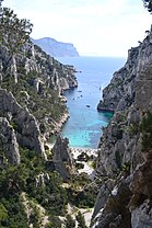
| photo2b = Calanque en.JPG
| photo4a = France - Marseille (29881013814).jpg
| photo1a = Marseille panorama.jpg
| size = 280
| spacing = 2
| color = #FFFFFF
| border = 0
}}
|image flag=Flag of Marseille.svg <!--City flag-->
|image coat of arms=Armoiries de Marseille.svg <!--City coat of arms-->
|city motto={{lang|la|Actibus immensis urbs fulget massiliensis}}<br /> {{smaller|"Qyteti i Marsejës shkëlqen nga arritjet e tij"}}
|arrondissement=Marsejë
|canton=[[Kantonet e Marsejës|12 kantone]]
|subdivisions entry=Nënndarjet
|subdivisions=16 [[Qarqet e Marsejës|qarqe]]
|coordinates= {{coord|43.2964|5.37|format=dms|display=inline,title}}
|mayor=Benoît Payan
|party=PS
|term=2020–2026
|area km2=240.62
|population=870731
|population date=Janar 2019
|population ranking=2ta në Francë
|urban area km2=1758.2
|urban area date=2020
|urban pop=1614501|urban pop date=Jan. 2019
|metro area km2=3971.8|metro area date=2020
|metro area pop=1873270
|metro area pop date=Janar 2019
|intercommunality=[[Aix-Marseille-Provence Metropolis]]
|postal code=13001-13016
|INSEE=13055
|dialling code=0491 or 0496
|website=[https://www.marseille.fr marseille.fr]
}}


