Stampa:KUTIAIndia
Kjo është kutiza për artikulli India
| भारत गणराज्य Bhārat Gaṇarājya Republika e Indisë | |||||
| |||||
 | |||||
| Gjuha | Gjuha Angleze, Gjuha Hindi | ||||
| Kryeqyteti | New Delhi | ||||
| Forma e qeverisë | Republikë federative parlamentare | ||||
| Kryeministri | Narendra Modi | ||||
| Kryetarë | Pranab Mukherjee | ||||
| Sipërfaqja | 3.287.590 km² | ||||
| Popullsia | 1.166.079.217 (vlerësim 2009) | ||||
| Dendësia e popullsisë | 349 për banorë në km² | ||||
| Valuta | Rupia / 100 pais | ||||
| Pavarësia | 15 Gusht 1947 - (Shpallur) | ||||
| Himni kombëtar | Jana Gana Mana | ||||
| Festa kombëtare | 26. Janar Dita e Republikës | ||||
| Zona kohore | UTC + 05:00 | ||||
| Targat e automjeteve | IND | ||||
| Kodi i internetit TLD | .in | ||||
| Prefiksi telefonik | +91 | ||||
Atlasi
[Redakto nëpërmjet kodit]Harta të përgjithëshme

|
Map of India |

|
Map of India |
| [[|border|250x400px]] | Map of India |

|
Labelled map of India showing international borders, state borders, district borders, rivers and lakes |

|
South Asia in local languages |
| [[|border|250x400px]] | Topographical map |

|
Physical map |

|
Physical map |
Harta të njësive
Në këtë seksion janë paraqitur harta të njësive shtetrore, administrative dhe teritoriale.

|
States and territories of India |

|
States and territories of India |

|
States and territories of India |

|
Map of India with territories marked |

|
Districts of India |
{{left|Image:India disputed areas map.svg|India disputed areas}]
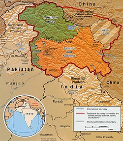
Maps of Kashmir

|
Kashmir |
|
Divided Kashmir |

|
Kashmir |
Harta historike
Seksioni përmbanë harta historike të sipërfaqes së sotshme ku nodhet India si dhe harta të vendeve në përbërje të së cilave ishte kjo sipërfaqe.
|
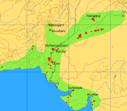
Indus Valley Civilization (2600-1900 BCE) |
|
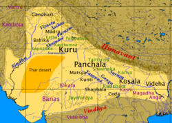
Vedic civilization (1500-500 BCE) |

|
Vedic civilization |

|
"Bharatvarsha" (Kingdom of India) during the time of Mahabharata and Ramayana |

|
Ancient India 600 BC |
|
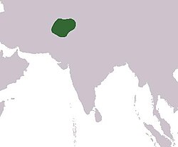
Gandhara |

|
Magadha (500 BCE) |

|
Nanda Dynasty (400 BCE) |

|
Maurya and Gupta Empires |
| [[|border|250x400px]] | Mauryan Empire (250 BCE) |

|
Mauryan Empire |
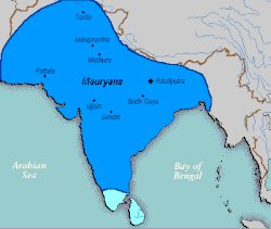
|
Mauryan Empire |

|
Mauryan Empire |

|
Gupta Empire |

|
Satavahana empire |

|
Indo-Greek kingdom (180 BCE-10 AD) |

|
Indo-Greek Kingdom |

|
Indo-Greek Kingdom |
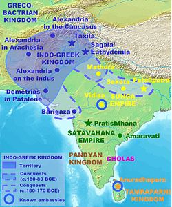
|
Indo-Greek Kingdom |

|
Kalinga |
| [[|border|250x400px]] | Kushan Empire |
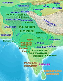
|
Kushan Empire |

|
Western Kshatrapas(35-405 AD) |
| [[|border|250x400px]] | Chera Dynasty |

|
Pandyas (100-1250) |
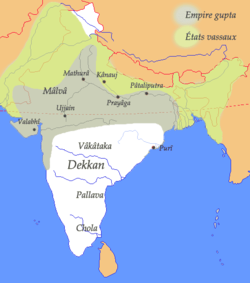
|
Gupta Empire (400 AD) |

|
Gupta Empire |

|
Gupta Empire |

|
Gupta Empire |

|
Kalabhras (400) |
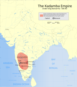
|
Kadamba Empire (450) |

|
Hephthalite dominion (520) |

|
Harsha's Empire around 600 |
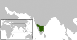
|
Pallava (645) |

|
Pratihara (6th-11th century) |

|
Rajput Kingdoms (7th-11th Century) |
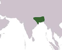
|
Pala Empire (700-1200) |
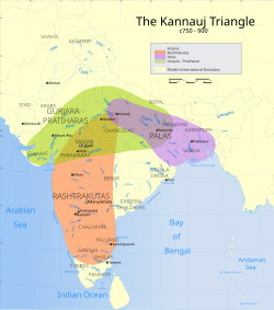
|
Kanauj Empire (750-900) |

|
Rashtrakuta Empire (750-900) |

|
Chola Empire (1050) |

|
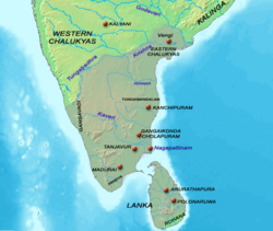
Chola Empire |
|
Chola Empire |

|
Chola Empire |

|
Chalukya (735-1120) |

|
Rashtrakuta (780) |

|
Rashtrakuta (780) |

|
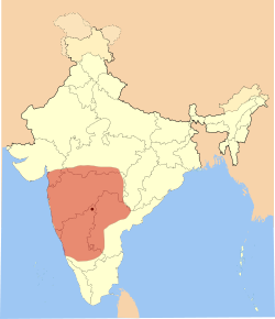
Rastrakuta (735-982) |
|
Western Chalukyas (973-1200) |

|
Hoysala Empire (1000-1346) |

|
Vijayanagara Empire (1336-1646) |

|
Delhi Sultanate (13th century) |

|
Delhi Sultanate during the Tughlaq dynasty 1320-1330 |

|
Delhi Sultanate under Iltutmish |

|
South India in 1500 |

|
Kingdom of Mysore (1400-1947) |

|
Sher Shah's Empire (around 1500) |

|
European settlements in India 1501-1739 |

|
Mughal Empire (1600) and European possesions |

|
Mughal Empire in 1605 |

|
Mughal Empire (1700) and Maratha Confederacy (1860) |

|
Mughal Empire (1526-1857) |

|
Mughal Empire |

|
Mughal Empire |

|
Mughal Empire 1690 |

|
India 1700-1792 |
|
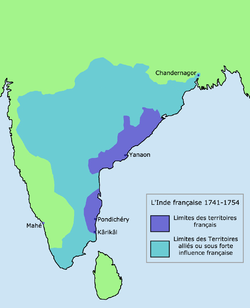
French India 1741-1754 |

|
Maratha Empire in 1760 |

|
Maratha Confederacy 1790 |

|
Maratha Empire |

|
Maratha Empire |

|
British India 1860 |

|
British India, not including Burma |

|
Revolt of 1857 |

|
Anglo-Mysore Wars |

|
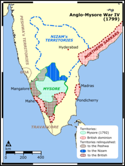
Anglo-Mysore Wars |
|
Anglo-Mysore Wars |

|
Britain's holdings on the Indian subcontinent were granted independence in 1947 and 1948, becoming four new independent states: India, Burma (now Myanmar), Ceylon (now Sri Lanka), and Pakistan (including East Pakistan, modern-day Bangladesh) |
| Skeda:India-partition.gif | Partition of India |

|
Partition of India |
Old maps
This section hold copies of original general maps older than 70 years of this entry.
|
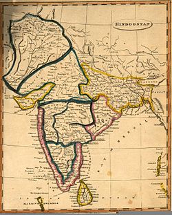
Hindustan in 1812 by Arrowsmith and Lewis |
|
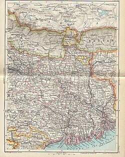
Map of Bengal 1893 |

|
Map of Eastern Bengal and Assam 1907 |
Ethno-linguistic maps

|
Languages of South Asia |

|
Indo-arian languages |

|
Dravidian languages |

|
Cultural regional areas |

|
Hindi Belt |

|
Literacy rate |

|
Literacy rate |
Other maps

|
Geology map |
|
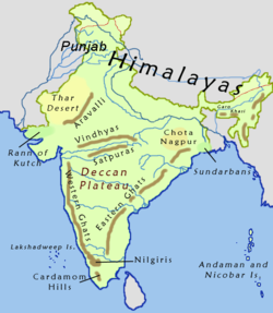
Hills of India |

|
Rivers of India |

|
Rivers and lakes of India |

|
Annual rainfall |

|
Indian Summer |

|
Wind Zone map |

|
Natural hazards |

|
Temperature map |
|
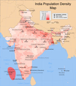
Population density |

|
Decadal growth rate |

|
Air- and seaports |

|
Geological map |

|
Climatic zones |

|
Annual rainfall |

|
Average annual temperature |

|
Climatic disaster risk |

|
Earthquake zones |

|
Flood zones |

|
Sex ratio |

|
Jewish communities |

|
Railways |
satellite-maps
[Redakto nëpërmjet kodit]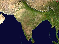
|
Satellite map |
Shënime
[Redakto nëpërmjet kodit]Stampa:KUTIAAfganistani · Stampa:KUTIAArmenia · Stampa:KUTIAArabia Saudite · Stampa:KUTIAAzerbajxhani · Stampa:KUTIABahraini · Stampa:KUTIABangladeshi · Stampa:KUTIABrunei · Stampa:KUTIAButania · Stampa:KUTIABirmania · Stampa:KUTIAEmiratet e Bashkuara Arabe · Stampa:KUTIAFilipinet · Stampa:KUTIAGjeorgjia · Stampa:KUTIAIndia · Stampa:KUTIAIndonezia · Stampa:KUTIAIraku · Stampa:KUTIAIrani · Stampa:KUTIAIzraeli · Stampa:KUTIAJaponia · Stampa:KUTIAJemeni · Stampa:KUTIAJordania · Stampa:KUTIAKamboxhia · Stampa:KUTIAKatar · Stampa:KUTIAKazakistani · Stampa:KUTIAKina · Stampa:KUTIAKirgistani · Stampa:KUTIAKoreja Jugore · Stampa:KUTIAKoreja Veriore · Stampa:KUTIAKuvajti · Stampa:KUTIALaosi · Stampa:KUTIALibani · Stampa:KUTIAMalajzia · Stampa:KUTIAMaldives · Stampa:KUTIAMongolia · Stampa:KUTIANepali · Stampa:KUTIAOmani · Stampa:KUTIAPakistani · Stampa:KUTIAQipro · Rep. Kineze Tajvan · Stampa:KUTIARusia · Stampa:KUTIAShiri Lanka · Stampa:KUTIASingapuri · Stampa:KUTIASiria · Stampa:KUTIATailanda · Stampa:KUTIATaxhikistani · Stampa:KUTIATimori Lindor · Stampa:KUTIATurkmenistani · Stampa:KUTIATurqia · Stampa:KUTIAUzbekistani · Stampa:KUTIAVietnami


